

Cyclone Olwyn causes extensive damage along West Australia coast
Cyclone Olwyn moves down W Australia coast, Cyclone Nathan heads out to sea.
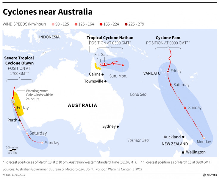
As Cyclone Pam causes widespread devastation in Vanuata, two other cyclones have hit the Pacific: Cyclones Olwyn and Nathan.
They are active in and around Queensland and Western Australia.
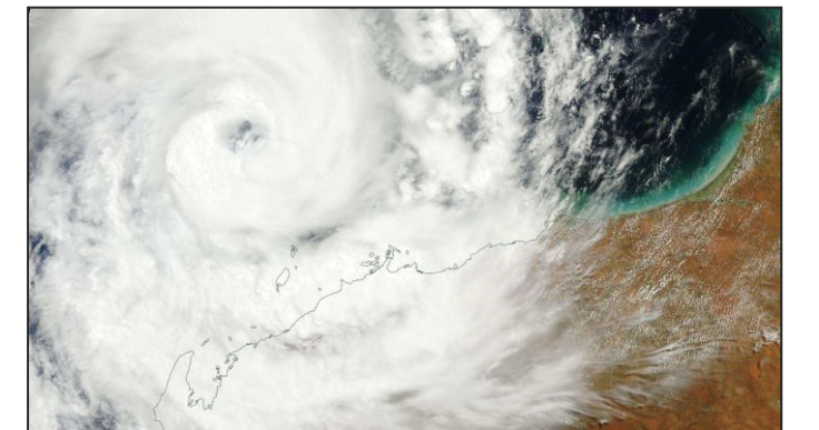
Cyclone Olwyn has caused extensive damage over the past 24 hours along the Western Australia coast.
It was a serious category three cyclone at its peak on Friday (13 March) when it hit the coastal towns of Exmouth, Coral Bay and Carnavon 900km north of Perth.
Carnarvon resident Karl Brandenburg says the town has been hit hard, with buildings badly damaged and extensive flooding. "The rain was horizontal, I watched one of my trees disappear in the backyard," he said. "I watched poles start to fall over down the street in front of my house and just trees everywhere."
"The rain was horizontal, I watched one of my trees disappear in the backyard," he said. "I watched poles start to fall over down the street in front of my house and just trees everywhere."
"There's tree debris everywhere, there's sheets of iron, roller doors, signs in the street," he said "Huge trees have been uprooted, roller doors have been caved in, roof sheeting is missing everywhere. A couple of houses are severely damaged, I'd envisage they're just about write off."
Brandenburg says the sound of the wind was like a roaring jet engine. Very large area of fruit crops are reported destroyed by its strong winds. Fortunately, the cyclone's weather system has now been downgraded to a tropical low, though it is still likely to cause severe rainfall in Perth and south-west
Large areas of fruit crops have been reportedly destroyed by Olwyn's strong winds.
Olwyn has been downgraded to a "tropical low" storm, which is likely to cause severe rainfall in Perth and Western Australia's costal regions. It is tracking down the coast in a south-south-easterly direction, with winds of up to 95km/h.
Australian Bureau of Meteorology (BOM) forecaster Matt Boterhoven says that Perth's far northern and eastern suburbs are likely to suffer most impact from the storm.
"It's going to be coming around Perth late morning to the early afternoon will be the risky period, and then from evening should ease off quite a bit," Boterhoven said.
Meanwhile, Cyclone Nathan, currently classed as a category one storm – the weakest form of cyclones – is moving slowly safely to the east away from the Queensland coast.
It is expected to maintain a general eastward motion during the next few days, while intensifying over the Coral Sea, which lies between Queensland and Papua New Guinea.
© Copyright IBTimes 2024. All rights reserved.


