Marine archaeologists recover rare ancient tool for navigating the seas from a 500-year-old shipwreck
The object was used by seafarers to measure the altitude of the Sun.
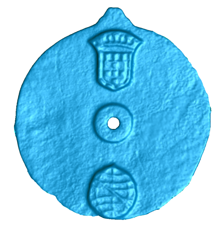
A device found in a shipwreck off Oman, is the oldest known example of a type of navigational tool, according to marine archaeologists. The object, called an astrolabe, is believed to date from between 1495 and 1500, was used by ancient seafarers to measure the altitude of the Sun.
The artefact was recovered from a Portuguese ship which sank during a storm in 1503. It was identified using pioneering scanning and 3D imaging tools which revealed navigational markings. The scans, conducted by Mark Williams from the University of Warwick, revealed invisible details which could not be seen with the naked eye, proving that it was indeed an astrolabe.
The markings would have enabled mariners to measure the height of the sun over the horizon at noon, in order to determine their location on the high seas.
"It was fantastic to apply our 3D scanning technology to such an exciting project and help with the identification of such a rare and fascinating item," said Williams.
"Usually we are working on engineering-related challenges, so to be able to take our expertise and transfer that to something totally different and so historically significant was a really interesting opportunity."
The astrolabe is disc-shaped and made of bronze, measuring around 17.5cm in diameter. The Portuguese coat of arms is engraved into it, in addition to the emblem of Don Manuel I, who was king of Portugal at the time of the sinking.
The ship, known as Esmerelda, was once part of a fleet led by Portuguese explorer Vasco da Gama – the first European to reach India by sea.
David Mearns, from Blue Water Recovery, who led the excavation, added: "It's a great privilege to find something so rare, something so historically important, something that will be studied by the archaeological community and fills in a gap. It was like nothing else we had seen... it adds to the history, and hopefully astrolabes from this period can be found."