

Malaysia Airlines MH370: Reunion Island debris will offer no clues to crash site of missing plane


The debris believed to be from missing flight MH370 will not offer any insight into where the plane crashed and it could take many more years to find fragments on the sea floor, an expert has said. French officials are currently analysing a piece of flaperon – a wing component of a Boeing 777 – that washed up on Reunion Island. While it is strongly suspected that the piece is from the MH370, authorities have not confirmed the find. They are currently carrying out land and sea searches to look for more potential pieces.
"The fact it showed up there [on Reunion Island] doesn't give us any indication as to how to trace back because the currents are so chaotic," Vicki Ferrini, a marine geologist at Columbia University's Lamont-Doherty Earth Observatory, told IBTimes UK. Arnold Gordon, head of the oceanography and climate physics division, said that while current models could be used to back track from Reunion to where the debris would have been in March 2014, this does not hold true for real life:
"Ocean currents are somewhat chaotic due to the large-scale circulation, to small-scale eddies, tides, wind and wave effects, so the debris is not expected to track along a smooth trajectory from the expected area of the MH370 disappearance some 4,000km from Reunion. Therefore the models would not a do a good job of pinpointing the crash site."
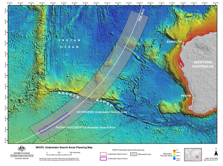
The search for MH370 has been ongoing since it disappeared on 8 March last year. Australian authorities have been leading the search, as it is thought that the plane crashed into the sea somewhere in the southern Indian Ocean. They are currently canvassing an area of more than 46,000 square miles and are expected to expand this area if nothing is found in the next month. At present, they have canvassed about 60% of the search area.
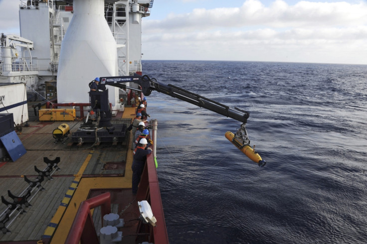
Ferrini said that as with the recovery of the Air France Flight 447, which crashed into the sea in 2009, scientists have had to take sonars closer to the sea floor to look for debris: "Typically when we map the deep sea, the most efficient way is from a ship – but that gives us pretty poor resolution because of the geometry of the sonar and the sound frequency used is lower resolution. In deep waters, the pixel size, or the grid size, is on the order of 100m or so, which is much larger than the plane if it was whole. So in order to be able to see we have to get down closer. The best technique is usually side-scan sonar to see this kind of debris, and to get to work well you have to get really close and in getting closer; your efficiency of surveying is much less because you cover much less ground, and it takes time.
"The other thing too with this particular crash is they have less of a pinpointed area to start from – with the Air France flight, within a couple of days they found floating debris and they were able to start honing in on a location. Whereas in this case it's a much bigger search area because of the nature of how communications were lost, etc."
It took investigators of the Air France flight almost two years after the crash to find the aircraft's black boxes on the ocean floor. It then took more than a year for France's BAE to release its final report on the accident. This, Ferrini said, shows just how poorly this part of the ocean is mapped. She said that while it is just a matter of time before investigators cover all the necessary ground with the right resolution sonars, there are a number of variables that make ocean mapping even more difficult. For example, researchers do not know how big the pieces of debris they are searching for might be.
"We are capable of mapping at very high resolution in the deep sea: I've done work where we've mapped at sub-metre resolution. You can imagine getting that sort of resolution takes a long time, and to do that over a large time takes even longer. They would presumably survey at a higher altitude to try to find some evidence, and if they see something, they could hone in and get closer.
"If you look at a map, there are some flat and featureless areas and others that are more peaked. Typically the basic assumption is that the more flat places are quieter, and there's more sediment on the surface. If that's the case, the debris would stand out much more readily than on a rough, rugged, hard bottom."
She said basing the searches on the last communications and information on how much fuel was remaining is probably "as good of a compass as any", but it appearing on Reunion Island does not offer any more clues to help solve the mystery: "It's not surprising it would land there: it doesn't give us too much, but it tells us it definitely landed in the water. I would expect it will be found eventually. The Air France search took two years to find, and we had a better idea of where it went down. So it's a matter of time and resources. It could be years and years."
What Ferrini said the case of MH370 highlights is how little we know about the ocean floor. It is often said we have mapped between 10 and 15% of the sea floor, but this is at a resolution of around 100m – to find pieces of debris, a far higher resolution is required.
"I think that as a world community, we've become accustomed to being able to zoom in on Google Earth and see a car on a driveway," she said. "With the ocean we just don't have that data, and we're fooled into thinking the whole planet is mapped because we see something in a map. But the effort and time it takes to map with that precision and resolution is much greater in the ocean. It's totally doable technologically, it's just time and money."
© Copyright IBTimes 2024. All rights reserved.
-

Football Clubs With The Most Arrests And Bans in 2022-23
-

Oil Prices Slip As Investors Eye Israel's Response To Iran Strike
-

Billionaire Declared Missing And Dead In 2018 Is 'Possibly Living In Moscow With Mistress'
-

Wendy's Sued For $20M After 11-Year-Old Gets Brain and Kidney Damage From 'Dirty Meal'


