

Nasa images show where Puerto Rico went dark after Hurricane Maria
The photos are intended to aid rescue operations.
Hurricane Maria swept through the island of Puerto Rico on 20 September, making landfall on what is being described as one of the worst storms to have hit the region. It is said that the hurricane hit the island with such ferocity that it has set the already-struggling island state back by a few decades.
Hurricane Irma passed by Puerto Rico on 7 September and the ensuing heavy rainfall had left the place reeling, and just as the island was recovering, Maria came by in just two-weeks time.
Maria was a Category 4 hurricane carrying 150mph (241kmph) winds when it made landfall, leaving Puerto Rico under a foot of rain water, say reports.
One of the results of the violent storm winds and rains was that it knocked out the power supply in quite a few areas on the island.
Ricardo Rossello, Governor of Puerto Rico, said that "this is a humanitarian disaster involving 3.4 million US citizens".
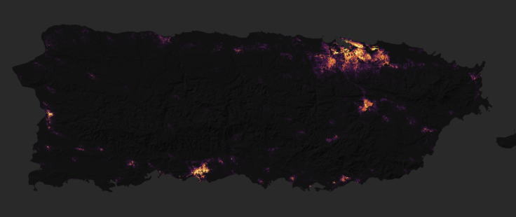
Nasa reports that most of the powergrid and communications have been severely affected, and released images to help responders quickly identify the areas where power has been out and for how long. This will also make it possible for groups like the National Guard and Federal Emergency Management Agency (FEMA) to send in repair crews and distribute supplies with the help of the high-quality satellite images.
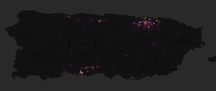
The images, Nasa said, have been put together using information collected from Puerto Rico's night-time lights captured by by the Suomi NPP satellite and data put together from the Visible Infrared Imaging Radiometer Suite (VIIRS) "day-night band". A Nasa report says that this particular device helps detect light from wavelengths that are near infrared to reflected moonlight, light from fires, lightning, and also emissions from cities or other human activity.
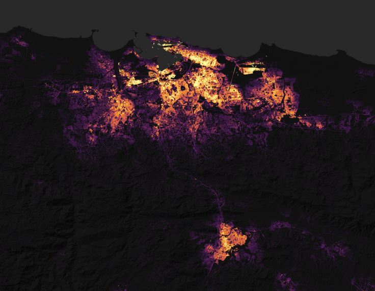
The images show the before-and-after effects of Hurricane Maria and, according to the report, were shot at a time when there was low moonlight and cloud cover. The most recent images show the island on 27 and 28 September.
There are "widespread outages" around San Juan, the capital city, including key areas like hospitals and other transportation infrastructure, says the report.
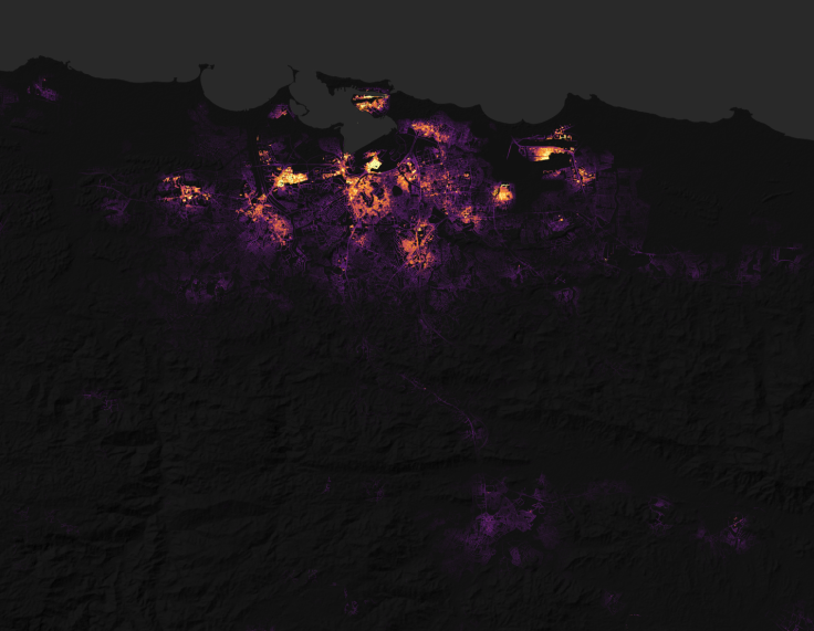
Nasa notes that the images do not show raw light, but are composites put together by researchers and scientists from the Goddard Space Center. The images have filtered out stray light from the Moon, fires, airglow, and any other sources which are not electric lights. The process also removes interference from clouds, dust and haze.
"It is critical that we get this processing done quickly, so that we can provide the cleanest and most useful imagery to the National Guard, FEMA, and other first responders," said Miguel Roman, who is leading the effort from Goddard.
"Uncorrected images can be misleading because of things like cloud cover and changing moonlight conditions," Roman added.
© Copyright IBTimes 2024. All rights reserved.


