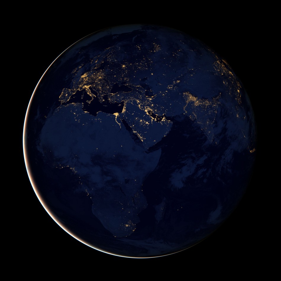
NASA Releases Stunning Night Images of Earth as Seen from Space [PHOTOS]
NASA has released a set of images that show Earth during night time, as seen from space. The global composite images show our planet as layered with lights, which change in intensity depending on the country and source (either natural or man-made).
The photographs were constructed using cloud-free night images from a new NASA and National Oceanic and Atmospheric Administration (NOAA) satellite - the Suomi National Polar-orbiting Partnership (NPP) satellite.
"The data was acquired over nine days in April 2012 and 13 days in October 2012. It took 312 orbits to get a clear shot of every parcel of Earth's land surface and islands," NASA said in a statement.
The NASA-NOAA NPP satellite, which was launched last year, is equipped with a new sensor that can observe the Earth's atmosphere and surface during night time.
"The new sensor, the day-night band of the Visible Infrared Imaging Radiometer Suite (VIIRS), is sensitive enough to detect the nocturnal glow produced by Earth's atmosphere and the light from a single ship in the sea," NASA continued, adding, "The the VIIRS day-night band can better detect and resolve Earth's night lights."
During the release of the photographs at a news conference at the American Geophysical Union meeting in San Francisco on 5 December, scientists said the photographs were the most detailed images of the Earth (at night) ever seen and could help researchers with valuable data for a range of previously unseen or poorly seen events. For instance, the satellite captured a night image around the time of Hurricane Sandy that shows a more complete view of the storm.
"NOAA's National Weather Service is continuing to explore the use of the day-night band. The very high resolution from VIIRS data will take forecasting weather events at night to a much higher level," Mitch Goldberg, program scientist for NOAA's Joint Polar Satellite System, said.
Scroll down to view the beautiful images of Earth, as seen from space, taken by NPP satellite during the night...


© Copyright IBTimes 2024. All rights reserved.


