

Nasa releases photos of melting glaciers on Greenland
This year's summer Icebridge mission started on 25 August and will go on till 21 September.
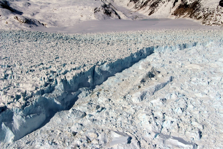
Operation IceBridge is an ongoing Nasa mission that maps and charts the melt of land ice over the poles. This summer's operation is being carried out in Greenland.
Nasa says that the paths that are taken during summer to cover the region will be repeated again in the spring to monitor seasonal changes in the ice sheets and study their elevation. Joe MacGregor, IceBridge's deputy project scientist and a glaciologist with Nasa's Goddard Space Flight Centre in Greenbelt, Maryland, said, "We started to mount these summer campaigns on a regular basis two years ago.
"If the flights go as expected, the result will be a high-quality survey of some of the fastest melting areas in Greenland and across as much of the island as possible," he added.
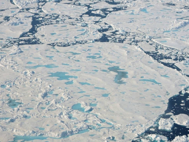
In the first weeks of this campaign, Nasa reports that Icebridge was based on the Thule airbase in north-western Greenland where they say the melting season ends earlier than most other regions in the country. The mission was to survey it before the start of any snowfall, says Nasa.
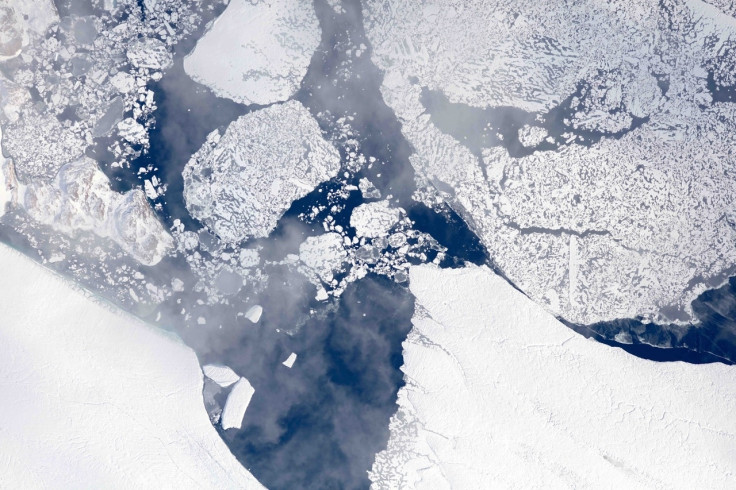
Starting from Thule, the survey is reported to have covered most of the north-western coast off Greenland and study what they call the "fast-changing" Zachariæ Isstrøm, Nioghalvfjerdsfjorden, and Petermann glaciers.
Starting 1 September, the mission reportedly moved toward central-western Greenland and flew over fast-changing areas in that location, namely, the Jakobshavn Isbræ and Helheim Glacier.
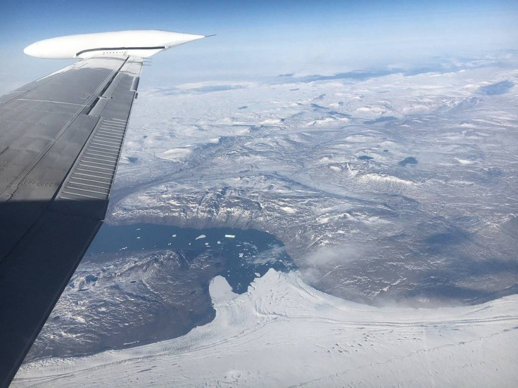
Icebridge will be flying 16 flights in all, says a Nasa report, and will be using a B200T King Air aircraft from Dynamic Aviation. It will also be carrying on board instruments like the Land, Vegetation and Ice Sensor, a laser instrument that measures changes in the ice elevation built by Goddard that can measure with an accuracy of higher than 4 inches, and a high-resolution camera.
The flights will be cruising at an altitude of 28,000 feet (8,534 m). "For this campaign, we're mapping as broad an area as possible, because we want to understand the seasonal cycle of elevation change across the entire ice sheet," MacGregor explained.
Icebridge is a mission bridging the gap formed between the two ICESat missions. ICESat-1 started in 2003 and ended in 2009; ICESat-2 will be launched in 2018. Icebridge started in 2009 and will run till 2019. The one year overlap between Icebridge and ICESat-2 will help Nasa validate the observations made by the satellite, reports Nasa.
© Copyright IBTimes 2024. All rights reserved.
-

No.1 2024 WNBA Draft Pick Caitlin Clark To Earn Less Than The Average Police Detective
-

Billionaire Declared Missing And Dead In 2018 Is 'Possibly Living In Moscow With Mistress'
-

Wendy's Sued For $20M After 11-Year-Old Gets Brain and Kidney Damage From 'Dirty Meal'
-

EU Sanctions Policy Is Attracting Growing Controversy


