

Space Satellite Radar Maps Show Volcanoes 'Bulging with Magma' Before Eruptions

Volcanology has come a long way since the days of Pompeii and now, satellites launched by the European Space Agency may offer a way of predicting whether a volcano is going to erupt.
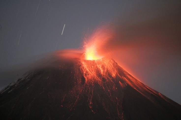
It is established that volcanoes deform before an eruption, as the ground "inflates" under the pressure of rising magma beneath the surface. Satellite radar maps can be used to measure the deformation from space, to eliminate the need for sensors located on or near the volcano, especially in inaccessible areas.
Although scientists have several ways to monitor active volcanoes, this normally requires the placement of sensors to measure vibrations or changes in carbon dioxide or sulphur dioxide levels.
Jenni Barclay, a volcanologist at the research consortium Streva (Strengthening Resilience in Volcanic Areas), said: "Improving how we anticipate [volcanic] activity using new research such as this is an important first step in doing better at forecasting and preparing for volcanic eruptions."
Streva, a research project run by the University of East Anglia, investigates volcanic risk assessment framework which can be used to reduce the "negative consequences of volcanic activity on people and assets".
A team of scientists looked at archived satellite data for more than 500 volcanoes around the world. The satellite radar revealed detailed maps of volcanic deformation, allowing the researchers to examine even the most inaccessible volcanoes.
Using statistics, the team found that 46% of deforming volcanoes erupted, whereas only 6% of volcanoes erupted without deforming.
Researchers said the findings suggest deformation can be a good indicator of eruptions, as satellite radar can be used to identify volcanoes "bulging with magma" which can then be investigated from the ground.
But sometimes, the magma stops short of the surface and no eruption occurs. Other factors can also lead to volcano deformation, such as the type of volcano rock, its tectonic characteristics, the depth of the magma and the rate at which it flows all play roles.
The satellite record is good for capturing volcanoes that erupt every few months or years, and these images often capture both deformation and eruption. For volcanoes with longer eruption cycles - such as every hundred thousand years, the satellite only captures one of these events, making it difficult to connect the two.
Typically, satellites capture radar images of volcanoes only a couple of times per year, so they may miss the shortest eruption cycles in which deformation precedes an eruption by just a few days.
Yet according to Live Science, the satellite observations may be the only warning of an impending eruptions in developing countries.
Future satellites will be launched more frequently to acquire more data. According to Space.com, the European Space Agency plans to launch its next radar mission Sentinel-1 this month, to "collect images all over the globe every six to 12 days".
© Copyright IBTimes 2024. All rights reserved.


