

Stonehenge Hidden Landscapes Project Reveals 17 Other Shrines in the Ground Below
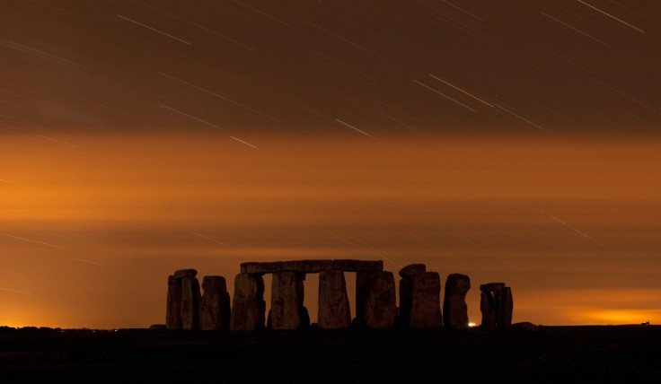
Using non-invasive geophysical prospection and remote sensing technology to probe the ground to a 3-metre depth, researchers have unveiled a detailed map of what lies beneath the Stonehenge landscape.
It turns out there are around 17 other shrines besides the 4500-year-old Stonehenge, including many burial mounds and a 6000-year-old trapezoidal shaped massive timber building.
Most of them were from the same period while a couple of them predate Stonehenge. The dating was done by studying the shape.
The Stonehenge Hidden Landscapes Project, led by the University of Birmingham in conjunction with the Ludwig Boltzmann Institute for Archaeological Prospection and Virtual Archaeology, has revealed massive prehistoric pits, some with astronomic alignments and captured new information on burial mounds, Bronze Age, Iron Age and Roman settlements.
The research done over four years scanning a 12 sq km area has yielded a three dimensional map of the ground below, giving glimpses into the ways and lives of civilisations that lived thousands of years ago.
The digital mapping throws more light on the Durrington 1.5 km wide 'super-henge' wall, tracking remains of a row of 60 massive posts or stones, up to three metres high. The timber building was probably used for the ritual inhumation of the dead following a complicated sequence of exposure and excarnation (defleshing).
The work unveiled two additional pits inside the Cursus trench aligned in the East-West direction. The pits were found one in each end, pointing to dusk and dawn, reports BBC.
More analysis will unearth more information but for now the scientists suspect the Stonehenge was not an excluded place meant for special people alone.
© Copyright IBTimes 2024. All rights reserved.
-

Football Clubs With The Most Arrests And Bans in 2022-23
-

Oil Prices Slip As Investors Eye Israel's Response To Iran Strike
-

Billionaire Declared Missing And Dead In 2018 Is 'Possibly Living In Moscow With Mistress'
-

Wendy's Sued For $20M After 11-Year-Old Gets Brain and Kidney Damage From 'Dirty Meal'


