

What caused the earthquake that has deformed New Zealand's landscape? (It wasn't supermoon)
Scientists believe earthquake may be a complex event involving several faults.
Brendan Duffy, University of Melbourne and Mark Quigley, University of Melbourne
At least two people have died in the magnitude 7.5 earthquake that struck New Zealand's South Island early on Monday, local time. Preliminary modelling suggests that the earthquake was caused by a rupture of a northeast-striking fault that projects to the surface offshore.
But this may be a complex event, involving several faults on the South Island.
The northern part of the South Island straddles the boundary between the Pacific and Australian tectonic plates. The jostling between these plates pushes up rocks that create mountains including the Southern Alps and the beautiful Seaward Kaikoura Range, one of New Zealand's most rapidly uplifting mountain ranges.
The plate motion forces the oceanic crust of the Pacific plate beneath the Australian plate on thrust faults, and also causes the plates to slide laterally with respect to one another on strike-slip faults.
The region affected by the recent earthquake has been one of the most seismically active in New Zealand over the past few years, including earthquakes that occurred as part of the Cook Strait earthquake sequence in 2013. It is likely that these sequences are related given their close spatial and temporal association.
What slipped during the earthquake?
The preliminary analysis strongly suggests that most of the energy release during this earthquake was sourced from the rupture of a roughly 200km-long fault system. This fault system is aligned northeast and dips to the northwest, beneath the northern part of the South Island. It coincides roughly with the subduction thrust in this area.
The potential for large earthquakes on the subduction fault in the lower North Island and upper South Island of New Zealand was recently highlighted by GNS Science, New Zealand's geological survey. It published evidence for two similar events in the Blenheim area roughly 520-470 years ago, and 880-800 years ago.
Given its setting, this latest earthquake may be structurally complex, involving a mixture of plate boundary thrusting, lateral slip on strike-slip faults, and thrusting within the Pacific plate close to the epicentre, some 15km northeast of Culverden.
The largest aftershocks suggest a mixture of thrusting and strike-slip movements.
The damage caused by the earthquake
Because the fault system was large, and the earthquake apparently started at the southwest end of the fault and propagated to the northeast, the seismic energy was released over a period of up to two minutes.
Large earthquakes produce more long period wave energy than smaller events. The 2011 Christchurch earthquake contained a lot of high-frequency energy and very strong ground accelerations, exposing more than 300,000 people to very strong to intense ground shaking.
In contrast, this recent earthquake was manifested in Christchurch as lower-frequency rolling, and due to the sparse population density in the earthquake region, roughly 3,000 people in the upper South Island experienced strong ground shaking equivalent to the Christchurch earthquake.
Reports are emerging of at least one major fracture in the ground surface that could be related to strike-slip faulting in the Clarence region.
More traces may yet be found given the complexity of the earthquake. Tide gauge analysis will help to understand if a similar trace offshore caused the tsunami.
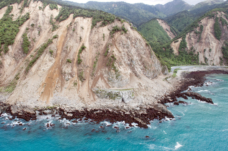
The earthquake has also triggered liquefaction in coastal areas and in susceptible sediments, and landsliding of up to a million cubic metres along steep susceptible cliffs in the northern South Island.
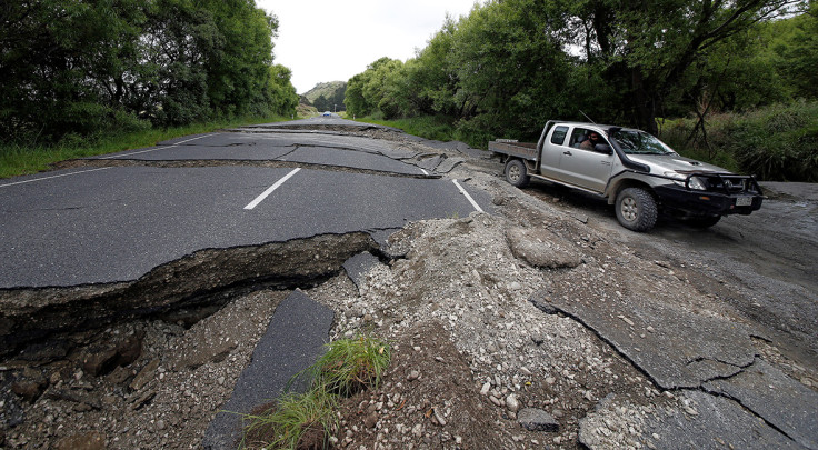
There are reports of extensive road damage including in the area between Hanmer Springs and Culverden, much of State Highway 1 and even Wellington, on the North Island.
Most of this damage is probably caused by strong ground shaking, which causes weak ground to move en masse and has resulted in numerous slips and road closures in the central and northern South Island.
Earthquakes, aftershocks and the pull of the moon
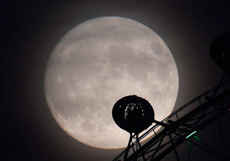
Given the earthquake happened on the eve of a supermoon full moon, and the closest the Earth and moon will be since 1948, it wasn't long before some tried to make a connection.
But the tidal triggering of earthquakes has been investigated since the 19th century and remains a challenging and controversial field.
Small amplitude and large wavelength tidal deformations of the Earth due to motions of the sun and moon influence stresses in Earth's lithosphere.
It is possible that, for active faults that are imminently close to brittle failure, small tidal force perturbations could be enough to advance rupture relative to the earthquake cycle, or to allow a propagating rupture to travel further than it might otherwise have done.
But the specific time, magnitude and location of this or any other large earthquake has not been successfully predicted in the short-term using tidal stresses or any other possible precursory phenomenon.
Deliberately vague predictions that provide no specific information about the precise location and magnitude of a future earthquake are not predictions at all. Rather, these are hedged bets that get media air time due to the romantic misinterpretation that they were valid predictions.
Most earthquake scientists, including those that research tidal triggering of earthquakes, highlight the importance of preparedness over attempts at prediction when it comes to public safety.
To this end, GNS Science uses a system of operational earthquake forecasts to communicate earthquake risk to concerned New Zealand residents during an aftershock sequence such as we are now entering.
These forecasts are based on earthquake physics and statistical seismology. The current operational forecast indicates an 80% probability of:
A normal aftershock sequence that is spread over the next few months. Felt aftershocks (e.g. M>5) would occur from the M7.5 epicentre near Culverden, right up along the Kaikoura coastline to Cape Campbell over the next few weeks and months.
This aftershock sequence will probably (98%) include several large aftershocks (some greater than magnitude 6 have already occurred), and for each magnitude 6 aftershock we expect 10 more magnitude 5 aftershocks over the coming days and weeks.
Brendan Duffy, Lecturer in Applied Geoscience, University of Melbourne and Mark Quigley, Associate professor, University of Melbourne
This article was originally published on The Conversation. Read the original article.
© Copyright IBTimes 2024. All rights reserved.
-

California Bill May Charge Employers $100 If They Call Or Text You Outside Of Work Hours
-

'You've Been Lied To About Buying Property': Multimillionaire On Why He Rents And Refuses To Buy Real Estate
-

Trump Says He Can End Russia-Ukraine War In 24 Hours By Giving Russia More Ukrainian Land
-

Businessmen Pay $18K To Join This Gruelling 3-day Bootcamp To Become Alphas
-

France Enshrines Abortion As Constitutional Right In World First


