

Winter Storm Jonas: How to track the deadly US blizzard with Google Crisis Map
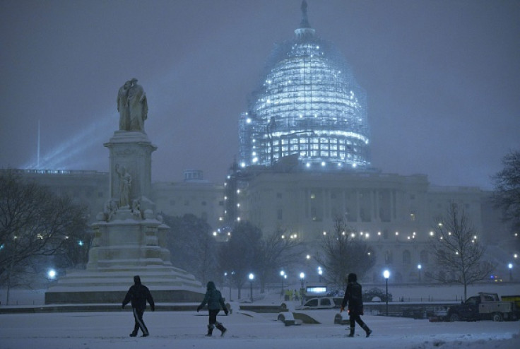
Winter storm Jonas, which is being called one of the worst blizzards in American history, is expected to hit the US East Coast today, with more than 70 million people across 10 states said to be affected. States of emergency have been declared in 10 US states and Washington DC, where more snow storm, fierce winds, and even coastal floods are expected.
Ten people have been killed until now as a result of the treacherous weather according to NBC. The US federal government in Washington DC was shut down on 22 January as it is expected to lie under a record 30in of snow by the time the storm passes on Sunday. Philadelphia and New York are also expected to get 12in-18in of snow before the storm abates.
Travel has been discouraged, except for emergencies, and people in the affected areas have been asked to stay indoors. Airlines have cancelled more than 7,100 flights for Friday and Saturday, according to flight tracking website FlightAware.com until now.
If you are travelling through the East Coast, live there there or just want to follow the storm's progress here are a few ways to track the deadly blizzard.
Google Crisis Map
Google's Crisis Map will help you zero in on areas most affected by the storm. As shown above, the dark orange depicts severe warnings and the light orange where advisories have been issued. So far the north-east is covered with the deep orange meaning heavy snowfall and harsh conditions.
You can zoom in and out to see in detail what the conditions in their cities or towns are. Indications will be also given about roads that have been closed and if any accidents have occurred. Red pointers will indicate nearby Red Cross Shelters.
The Weather Channel
Are you awake? We are & continue to bring you LIVE coverage off #Winter Storm #Jonas, tune in for latest! #DC #NYC pic.twitter.com/1pCokuagKJ
— The Weather Channel (@weatherchannel) January 23, 2016
The Weather Channel is a one-stop information point for information on Jonas, but also the scientific phenomenon behind it. It is the best guide for amateur weather surfers as its language is simple, yet detailed. Its interactive maps and graphics are also probably the best you can find online.
Weather Underground
Several stations along the MD/DE coast are reporting wind >40mph at this hour. https://t.co/GihuPZddyD pic.twitter.com/7ITbUhvx2s
— Weather Underground (@wunderground) January 23, 2016
Weather Underground which provides real-time weather information has a live blog of storm updates, in addition to radar and webcam footage all of which can be accessed through its apps.
Nasa
The Earth section on the Nasa website shows satellite imagery of the deadly storm and also tracks how the wind movements are shaping up. Nasa generally keeps updating their content in times like these so expect more such videos to show up.
Accuweather
Although most of the weather services have mobile applications now, Accuweather is by far one of the most popular downloads in that category. To download the app visit you Google's Play Store or Apple's App Store. The hourly updated charts are very easy to understand, but do not come with a lot of explanation for those who want a quick check on the weather.
Social Media
What better way than to track regular updates from agencies as well as residents affected by the blizzard then different channels of social media? Here are some accounts we think you should definitely follow for the Jonas.
Jim Cantoe: Probably the most well-known weather reporter, Cantoe, who extensively covers weather phenomenon for the Weather Channel, has gone all out with the winter storm as well. His updates are insightful and give you a detailed on the ground report of what's shaping up.
Look at the gravity wave striations in radar returns w/this intense snow area moving into Delaware and south Jersey! pic.twitter.com/hwsUrBOin1
— Jim Cantore (@JimCantore) January 23, 2016
The NWS and NWS Eastern: The National Weather Service and the National Weather Service's Eastern twitter handle should be on your follow list if you want quick and reliable updates for the Jonas storm.
Please review these storm safety tips. More info here https://t.co/GNqW95rP18 #dcwx #mdwx #vawx #wvwx #winterstorm pic.twitter.com/G6tAfecwG3
— NWS DC/Baltimore (@NWS_BaltWash) January 22, 2016
Most winter weather deaths are from traffic accidents, exertion heart attacks, hypothermia https://t.co/Et2iCi7OvI pic.twitter.com/C2Ywoqw9Pj
— NWS (@NWS) January 22, 2016
The NOAA Ocean Service: The National Ocean Service – the USA's premier federal science agency for the ocean and coasts – should also be followed for expected coastal flood warnings and wind movements across oceans.
NOAA posts special Storm QuickLooks for the significant Mid-Atlantic coastal winter storm https://t.co/2rQ8yO4mg6 pic.twitter.com/cUI00XkFg0
— NOAA's Ocean Service (@noaaocean) January 22, 2016
© Copyright IBTimes 2024. All rights reserved.


