

'Imagine if Hamas Were Your Neighbours': Israel Creates Dr Strangelove-Style Gaza Rocket Range Map

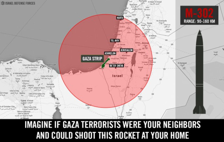
A chilling new web app developed by Israel in its propaganda war against Hamas maps the bewilderingly reach of M-302 rockets, which are fired daily by Gaza militants, onto your home location.
The effect is oddly reminiscent of the old nuclear threat diagrams which showed how the blast radius of atomic bombs could envelope entire continents.
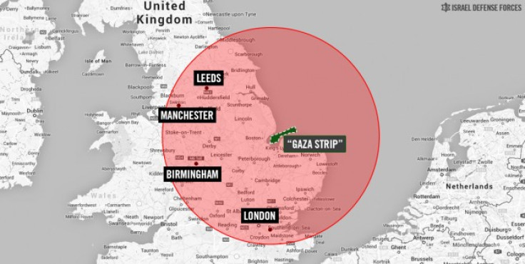
Viewers can type in their home city and then shudder in fear as an ominous red circle appears, covering a huge swathe of land.
We typed in "London" and discovered that the putative rocket range swept across the country from East Anglia to the middle of the English Channel.
The app, which illustrates its point by re-plotting Gaza over the seaside town of King Lynn encompassing Leeds and Manchester as possible targets, is intended to highlight the generous range of the M-302 rocket - which Israel blames Iran for placing in the hands of Hamas forces.
Indeed the entire country's paranoia was substantiated when the Northern Israeli town of Hadera was hit with a missile from Gaza.
Hadera is more than 100 kilometers (60 miles) north of Gaza; its residents have long known they were within range of rockets from Hezbollah guerrillas in Lebanon, but now they appear to be in the gunsights from both directions.
The corollary is that no spot in Israel is immune to attack from one source or the other.
Hence the app with its imagined Dr Strangelove-like spatial capacity for annihilation, and the insinuated question: what would you do if they were next door to you?
The answer as far as Israel is concerned is airstrikes.
© Copyright IBTimes 2024. All rights reserved.


