Mysterious shapes and patterns discovered in Arctic and Antarctic sea floor
The marks were carved into the sea floor in the polar regions thousands of years ago.

Thousands of kilometres of the Arctic and Antarctic sea floors have been charted in an ambitious and highly detailed atlas of the polar seabed. Several strange shapes gouged out of the sea floor reveal some of the more dramatic periods of the poles' past.
It's often said that we know more about the surface of Mars than we do about the Earth's ocean floors. What we do know about the seabed here on Earth is perhaps at its scantiest in the remote polar regions.
An atlas being presented at a meeting of the European Geosciences Union in Vienna is set to change that. The map covers an area larger than Great Britain and is the first attempt at an in-depth atlas of the regions in 20 years.
Kelly Hogan, a marine geophysicist at the British Antarctic Survey who worked on the atlas, presented the results.
"These are the fingerprints of the way the ice shapes the sea floor at these high latitudes," Hogan told a press conference.
"We took ships out across up to high latitudes and used echo-sounding methods, where you ping down a sound pulse to the sea floor and record the response back up at the ship."
This can be used to probe surface of the sea floor as well as the sediments beneath, creating a 3D map in high resolution.
"This is remote sensing of the sea floor – in the same way satellites are moving round the globe and taking images, this is what we're doing on ships but sending pulse down to seafloor instead," Hogan said.
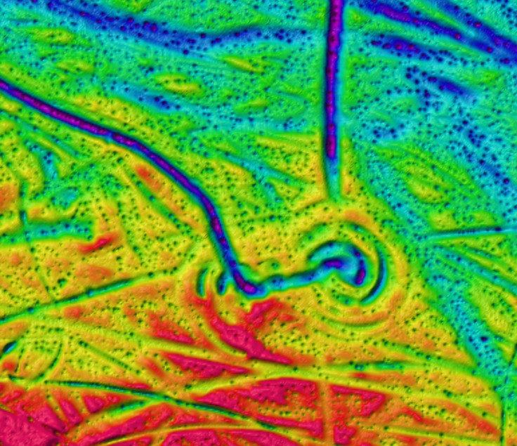
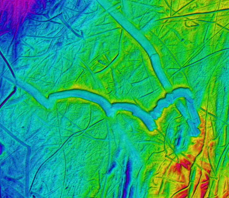
The images show the scars in the sea floor left by ice sheets and glaciers as they grew and retreated over thousands of years. A twirling ploughmark discovered in the Barents Sea in the Arctic shows how the tip of an iceberg rotated, with several prongs digging a series of circular trenches in the sea bed about 10 metres deep. It is thought to have been carved 12,000 to 15,000 years ago when the ice sheet in this area disintegrated and released large numbers of icebergs.
Other ploughmarks show loop-the-loops and large, shallow depressions where a much heftier iceberg ground its way past.
"The loopy ploughmark is the youngest and was probably formed by an iceberg calved from a surge of the Brasvellbreen glacier on Svalbard between 1936 and 1938, when the glacier advanced more than 15km along a 30-km long front," Hogan told IBTimes UK.
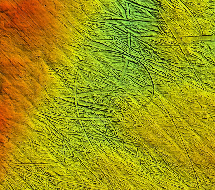
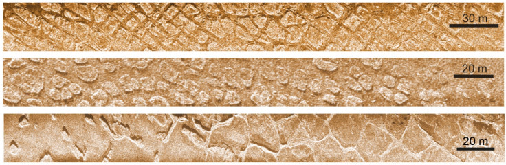
Another image shows polygons created by frost when that area of the sea bed was above ground during the last Ice Age. It was discovered in shallow waters of the Laptev Sea above eastern Siberia. These shapes are caused as the ground contracts in very cold conditions. It's thought that these polygons probably became submerged by the sea about 7,000-8,000 years ago, when sea levels rose at the end of the Ice Age.
It's hoped that these and other findings from the atlas will inform climate modelling research to get a better understanding of how the ice sheets behaved over the last tens of thousands of years. This could help climate scientists make more nuanced and accurate projections of climate change and sea level rises.
© Copyright IBTimes 2025. All rights reserved.
- MOST READ