

UK weather: Thunderstorm to hit London during rush hour bringing flooding and travel chaos
Torrential rain has sparked flooding alerts across the south-east as forecasters warn of 40mm of rain.

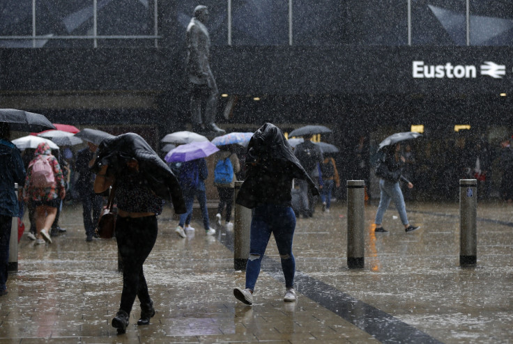
The UK's Met Office has issued a yellow "be prepared" warning for rain the Midlands, the east of England and the south-east. Forecasters have warned that thunderstorms are set to hit London at rush hour on 12 July, bringing fears of flooding and disruption to travel.
As much as 20-25mm of rain is expected in a short space of time, with up to 40mm falling in just two or three hours. The heaviest showers are scheduled to fall during the mid to late afternoon and early evening, coinciding with the rush hour traffic.
A chief forecaster for the Met Office said: "Heavy showers are expected to break out this afternoon and persist into the evening. Due to light winds, some these showers are likely to be slow-moving, leading to some localised prolonged, torrential thundery downpours."
The Environment Agency has issued five flood warnings in the south-east of the country, with a number of areas in London to be affected. The London boroughs of Wandsworth, Merton, Lambeth, Croydon and Sutton have been urged to be prepared for flooding, while West Ruislip and Harrow are also on alert.
The rain warning comes into effect at 12pm on Tuesday 12 July and is expected to remain in place until 10pm later that night. While the exact locations of the heaviest downpours remains uncertain, in areas where torrential rains do occur, large amounts of rain is expected to fall within a short time period.
Conditions are set to improve through the rest of the week, with the rain clearing after the thunderstorm on 12 July. Temperatures are expected to rise to as high as 25C by the weekend, with sunshine making it feel like summer.
On 10 July, forecasters at WeatherAction noted that the UK could soon see a "Spanish plume" of very hot air, bringing six weeks of 30C temperatures. While the whole of the UK is set to experience the heatwave conditions, the south-east will see 2-3 degrees of hotter weather from this week.
© Copyright IBTimes 2025. All rights reserved.
- MOST READ


