

Another fault has just been discovered running parallel to the San Andreas one
Potentially significant fault line could help explain why a large earthquake is way overdue.

A previously unmapped fault has been discovered running parallel to the famous San Andreas Fault line, scientists have announced. Named the Salton Trough Fault, researchers believe it could shed light on why the area is far overdue a large earthquake.
A swarm of almost 200 small earthquakes hit the Salton Sea area at the end of September. At the time, scientists warned the events could trigger a larger earthquake on the southern San Andreas Fault.
The Salton Sea sits roughly 160 miles south-east of Los Angeles and 125 miles north-east of San Diego. The San Andreas Fault itself is 800 miles long, forming the tectonic boundary between the North American Plate and the Pacific Plate.
In a study published in the journal Bulletin of the Seismological Society of America, scientists from the University of California, San Diego and the University of Nevada, Reno have found evidence of another previously unknown fault. "To aid in accurately assessing seismic hazard and reducing risk in a tectonically active region, it is crucial to correctly identify and locate faults before earthquakes happen," said Valerie Sahakian, lead author of the study.
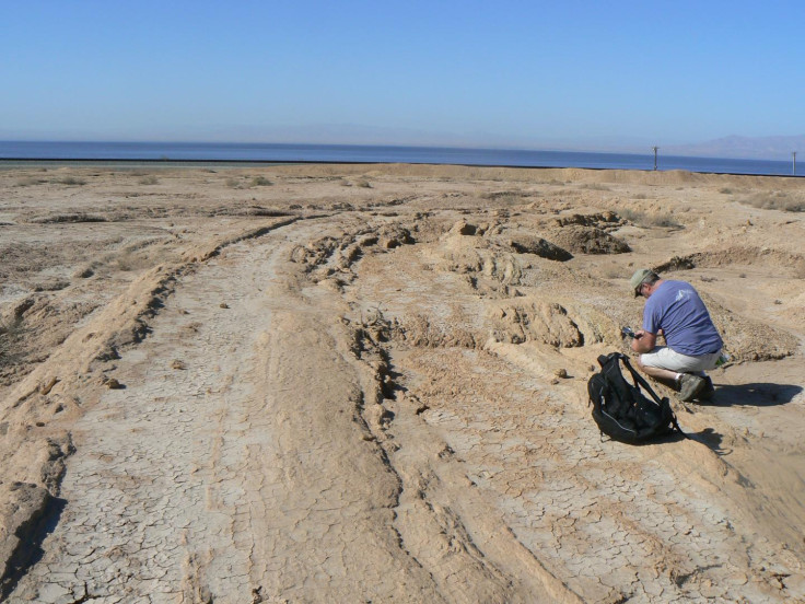
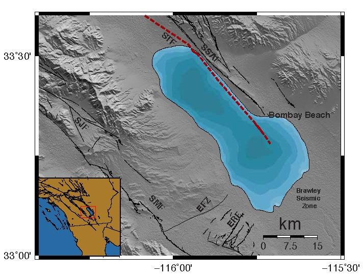
The newly discovered Salton Trough Fault runs parallel to the San Andreas Fault to the west, lying along the eastern edge of the Salton Sea. It was found by examining seismic data, including ocean-bottom seismometers, and light detection and ranging (lidar) technology that allowed the team to map the deformation of sediment layers on the floor of the sea. Findings showed a strike-slip fault in the Salton Sea.
"The location of the fault in the eastern Salton Sea has made imaging it difficult and there is no associated small seismic events, which is why the fault was not detected earlier," said Neal Driscoll, the lead principal investigator. "We employed the marine seismic equipment to define the deformation patterns beneath the sea that constrained the location of the fault."
The southern portion of the San Andreas Fault normally ruptures every 200 years, producing magnitude 7 earthquakes. However, it has been 300 years since the last – making it something of a question mark for scientists. The team believes this newly discovered fault could play a role in explaining why a large earthquake has not struck for such a long time.
"The extended nature of time since the most recent earthquake on the Southern San Andreas has been puzzling to the earth sciences community," said Graham Kent, a co-author of the study. "Based on the deformation patterns, this new fault has accommodated some of the strain from the larger San Andreas system, so without having a record of past earthquakes from this new fault, it's really difficult to determine whether this fault interacts with the southern San Andreas Fault at depth or in time."
They said further research will be needed to understand how the Salton Trough Fault interacts with the San Andreas Fault, and what danger it poses. "The southern San Andreas fault (SSAF) accommodates a significant amount of strain between the Pacific and North American plates; thus, the fault represents a major geohazard to the populated areas of southern California, in particular the larger Los Angeles metropolitan area ... From a seismological hazards perspective, the presence of [the Salton Trough Fault] could alter the current understanding of stress transfer and rupture dynamics in the region, as well as community fault models and ground‐motion simulations on the SSAF," the researchers concluded.
© Copyright IBTimes 2025. All rights reserved.
- MOST READ


