

Boxing Day Tsunami: Scientists drill deep in ocean to find out why Indonesia earthquake was so deadly
Dehydration of sediments played a key role in triggering the earthquake.


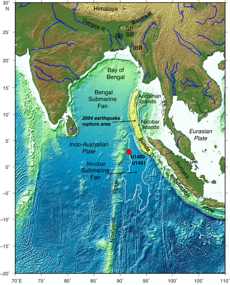
Scientists have long been puzzled about why the 2004 Sumatra-Andaman earthquake was so devastating, as it didn't unfold as traditional hazard models would have expected. New analyses of the sediments entering the subduction zone have allowed them to come up with a potential explanation.
The 2004 earthquake, was an event with a magnitude of 9.1 struck of the coasts of the Indonesian island of Sumatra. It was accompanied by a huge tsunami – which remains known today as Boxing Day tsunami because it occurred on 26 December.
Giant waves devastated coastal areas across the Indian Ocean and caused the death of more than 225,000 people.
The scale of the earthquake and of the tsunami surprised researchers because sediments in the area are particularly thick – a feature which is thought to limit the size of earthquakes.
In a study published in the journal Science, a team led by Andre Hüpers (Bremen University, Denmark) attempted to find out more about the kind of sediments present near the Sumatra subduction zone and how they had contributed to the natural disaster.
Read more: Boxing Day Tsunami: Facts about the disaster
Drilling deep
The scientists drilled into the sediments near the subduction zone, from the sea floor down to the oceanic crust, collecting samples at two sites. They analysed them to find out what type of sediment was pouring into the subduction zone.
"We knew already that the sediments were thick. But during our two-month expedition, we performed several kind of analyses to determine the composition of the sediments, what kind of minerals there were, and their geochemical properties. We also measured physical properties like the density of the sediments as well as thermal properties - so we actually did in situ measurements of the temperature", Hüpers told IBTimes UK.
A process of dehydration of sedimentary minerals deep below the ground usually occurs within the subduction zone and determines the location and extent of slip between the tectonic plates, and thus the strength of an earthquake.
The scientists' analyses revealed that the thick sediments in the area around the subduction zone are exposed to very high temperatures and actually become greatly dehydrated before pouring in the subduction zone.
This strengthened the fault and led to increased unstable seismic activity over great distances - and ended up generating the massive tremor and tsunami of 2004.
"What we saw from our geochemical analysis is that sediments at the bottom are dehydrating. Normally, this is something we see when the sediments have entered the subduction zone, but not before. We believe this process played a role in the seismic activity that resulted in the 2004 earthquake", Hüpers explained.
These findings derived from the analysis of the Sumatran core samples may be applicable to other subduction zones around the world that have thick input sediments or high temperatures.
"Our study has implications for margins where we see similar geological conditions – for example the north pacific region of North America and the south coast of Iran and Pakistan. These features could influence the strength of potential future earthquakes in these areas", Hüpers concluded.
© Copyright IBTimes 2024. All rights reserved.
-

Doug McMillon Unloaded Walmart Trucks For $6.50/Hour In 1984, Now He's The CEO
-

How Are Female Tech Firms Fighting the Employment Crisis in the West Bank?
-

Italian PM Has British Newborn With Heart Defects Airlifted to Rome for Treatment Unavailable in UK
-

Sugar Baby Gets 9 Years In Jail For Scamming $1M From Men And Selling How-to Manuals


