

Mystery of the missing hot magma beneath Mount St Helens solved
The melt source region for Mt St Helens does not reside directly beneath the volcano.

The melt source region for Mount St Helens may not lie directly below the volcano but further east, scientists have found out. This discovery challenges current knowledge about the source region of hot magma in active volcanoes.
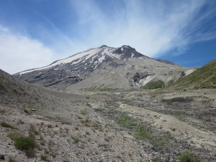
Mount St Helens is located in the state of Washington, along the North American Cascade Arc. It is considered to be the more active of the region – in fact, it is often described as one of the most active and hazardous volcanoes in the world due to its proximity to large population settlements.
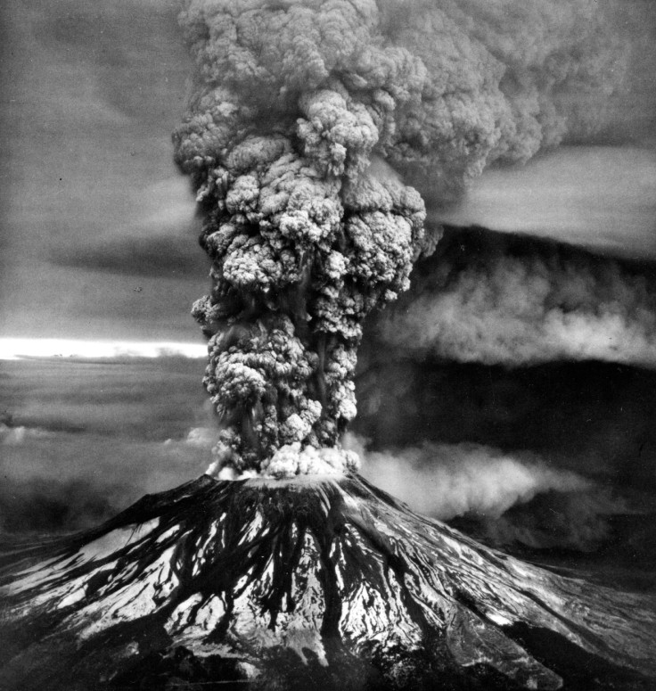
In May 1980, a large earthquake struck below the north face of Mount St Helens in Washington state, triggering one of the largest landslides in recorded history and a massive eruption that deposited ash in 11 US states. Fifty-seven people lost their lives in the natural disaster.
In the aftermath of the eruption, scientists have learnt a lot about the shallow magmatic system at Mount St Helens. They have established that most of the eruptive products were derived from one or more upper-crustal magma chambers located at depth comprised between 3km and 12 km.
However, the structure of the deep magmatic system beneath St Helens has remained poorly documented. In particular, scientists have been puzzled by the results of seismic experiments which have shown that the mantle below the volcano, where hot magma would normally be expected, is cold and unlikely to generate melt.
In this study published in the journal Nature, scientists from the University of New Mexico have attempted to solve this mystery and to identify the source region of melt and the extent of the cold mantle wedge.
They have analysed high-resolution active-source seismic data collected during the summer 2014. They observed that clusters of deep earthquakes in the crust – 23km to 44 km deep – have occured southeast of Mount St Helens.
These earthquakes are reflecting magma movement and suggest that the lower crustal source region of melt resides south-east of the volcano near a mountain known as Mount Adams.
Eruption of Mount St Helens
The eruption of Mount St Helens took place on 18 May 1980. It sent a column of rock, ash and gas 15 miles into the air and deposited ash across 11 states. The volcano had shown signs of seismic unrest from March, with hundreds of earthquakes being recorded by the end of the month.
The eruption released 24 megatons of thermal energy and caused widespread destruction, with pyroclastic flows pouring out of the crater at up to 80 miles an hour, covering an area of six square miles. Fifty-seven were killed as a direct result from the eruption.
© Copyright IBTimes 2025. All rights reserved.
- MOST READ


