Underwater volcanoes caught in the act of erupting in unprecedented detail
About 80% of the world's volcanic activity happens underwater - now scientists have caught an eruption in the act.

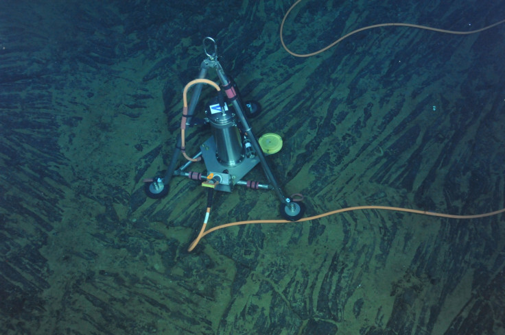
Eruptions of volcanoes on the sea floor have been caught and monitored in real time using an underwater observation station for the first time.
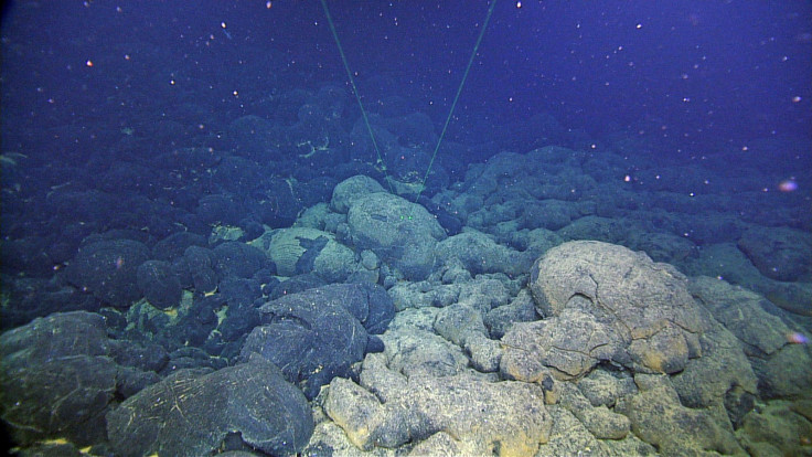
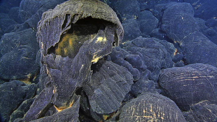
Scientists set up a seven-station observatory on the sea floor at the Axial Seamount off the coast of Oregon in 2014. They could have had to wait for years before an eruption, but they were lucky. Just a year later they managed to record remotely an explosive eruption at the site, with magma erupting and spilling onto the sea floor.
This gave them valuable data to be able to map exactly what happens at an underwater volcano in the moments leading up to, during and after an eruption.
"The new network allowed us to see in incredible detail where the faults are, and which were active during the eruption," said William Wilcock of the University of Washington in the US, and author of a paper using the data to analyse the volcanic crater, or caldera, published in the journal Science.
"We have a new understanding of the behaviour of caldera dynamics that can be applied to other volcanoes all over the world."
"There has been a longstanding debate among volcanologists about the orientation of ring faults beneath calderas: Do they slope toward or away from the centre of the caldera?" Wilcock said. "We were able to detect small earthquakes and locate them very accurately, and see that they were active while the volcano was inflating."
The findings show the activity of the underwater volcanoes in minute detail that will help with the study of volcanoes on land too, volcanologist David Pyle of the University of Oxford in the UK, who was not involved in the research, told IBTimes UK.
The data can be used to map out what the eruption would look like from above, pinpointing where earthquakes happen at the time of the eruption and to see how the cracks in the crust spread with magma flowing into them.
"At the tip of the dike you'll be fracturing rock to break it open and then the magma will push along the dike behind that. So they can see how that dike is moving."
There have been a few observations of this this kind above ground in Ethiopia and Iceland, Pyle says, but not underwater.
"So effectively, because they have such good spatial and time resolution, they can see changes of pressure inside the volcano system. They can interpret this directly in terms of magma spreading out along a fracture."
The same network was used to predict an eruption in 2015 at the Axial Seamount site. Authors of a second paper using the data, also published in Science, studied patterns of deformation in the sea floor to see how magma was moving under the surface.
They saw a notable bulge in the magma reservoir underneath the site prior to the eruption. They initially thought that the site would erupt in 2018, but a more rapid deformation at the site led them to bring their prediction forward to 2015.
© Copyright IBTimes 2025. All rights reserved.
- MOST READ