

Hurricane Gonzalo To Hit Britain Next Week
Met Office warns ex-hurricane set to hit Britain
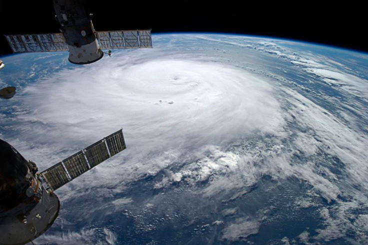
Hurricane Gonzalo will head to the UK this week after battering Bermuda and other Caribbean islands, the Met Office has warned.
Hurricane Gonzalo is expected to downgrade in strength before hitting the UK, and will be an ex-hurricane by the time it reaches British shores on Monday and Tuesday.
The Met Office issued a yellow warning for higher-than-usual winds in parts of the UK, including the north of London to northern England, parts of north Wales and Northern Ireland, as well as south-west Scotland.
The yellow warning has been put in place due to level of damage that could be sustained – most notably through rush hour – on the roads, as well as damage to trees which could cause further destruction or injury.
Simon Partridge, a forecaster at the Met Office, said: "It will be a very ex-hurricane by the time it reaches us. What is left of it will be strong winds – some gale force winds at times – and it is currently expected to arrive late Monday night or early Tuesday morning and is tied into the reason why we've issued a yellow warning for wind."
"Some of the stronger winds will be at its tail-end heading north-westerly. Britons could feel like the temperature has lowered somewhat the day after it arrives. Wednesday will feel cooler [amid the recent warm weather we've been enjoying], but it will be about average for this time of year."
The Met Office forecasts local gales and gusts, with possible wind speeds of 35mph and gusts up to 50mph.
Hurricane Gonzalo was a category 4 storm with sustained winds of 140mph – making it the most intense storm in the North Atlantic since Ophelia in 2011.
© Copyright IBTimes 2025. All rights reserved.
- MOST READ


