

Hurricane Gonzalo: Bermuda Braces Itself for Powerful 140mph Winds in Category 4 Storm

Bermuda is bracing itself for the arrival of Hurricane Gonzalo as the powerful Category 4 storm is set to batter the small British island territory.
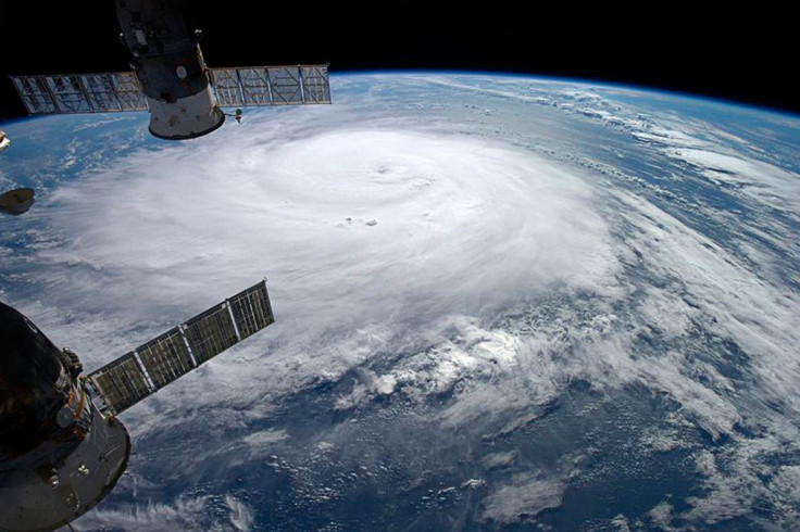
The US National Hurricane Centre in Miami has warned the hurricane could hit top wind speeds of 140mph (225km/h).
The storm is centred around 195 miles (310km) south-south-west of Bermuda and is expected to pass by the island at some point on Friday (17 October).
Strong tropical winds have already begun to hit the island, with the National Hurricane Center warning there will be a "life-threatening storm surge".
Rob Howlett, a meteorologist with the Bermuda Weather Service, said he predicts Gonzalo to pass within 29 miles of the island, close enough to be considered a direct hit.
Schools, airports and all public transportation are closed as the island prepares itself for the biggest hurricane it has seen for more than a decade.
The last major hurricane to strike Bermuda was Fabian in 2003, a Category 3 storm which killed four people.
More than 1,500 homes are still without power in Bermuda after it was hit by Tropical Storm Fay on 12 October.
In the UK, the Met Office has said there is "large uncertainty" on whether the remnants of the storm will pass over the UK or not.
A spokesperson said: "If the ex-tropical storm does move across the country, some parts could see gales and heavy rain, but currently extreme conditions look unlikely.
"Tied up in the general Atlantic circulation is an area of warm air which was originally part of tropical storm Fay.
"This will bring very mild air across parts of the country, with daytime temperatures possibly reaching around 20C across southeastern areas by Saturday (18 October), well above the October average for the region of 15C."
© Copyright IBTimes 2025. All rights reserved.
- MOST READ


