

Hurricane Harvey in pictures: Nasa releases stunning images of massive storm that wreaked havoc in Texas
Harvey was the biggest storm to hit Texas since Wilma in 2005.
Hurricane Harvey is dumping massive amounts of rain on Texas and is touted to be the biggest storm since Wilma in 2005. The rains are expected to continue till the middle of next week.
The hurricane is reported to have caused extensive damage to property and installations, and also claimed the lives of at least two people. More than 300,000 homes and business are said to be without power.
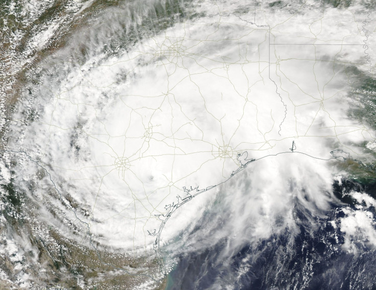
While Harvey has weakened and been downgraded to a category 1 storm, rainfall is expected to continue over Texas bringing up to 40cm of rain.
Apart from the various meteorological centres and weather research stations that are tracking the hurricane, Nasa has also been taking photographs and monitoring the storm since the time it formed over the Eastern Caribbean Sea.
The first images released were on 18 August and the space organisation continued to capture Harvey on camera and study it till it made landfall and weakened.
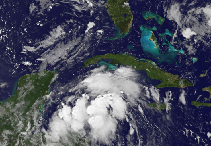
By 21 August, the storm had got stronger over the western Caribbean Sea. Nasa said there were "several areas of disorganised and fragmented thunderstorms". The National Hurricane Centre (NHC) reported that heavy rainfall and winds were likely to spread across northern Nicaragua, Honduras, Belize and the Yucatan Peninsula.
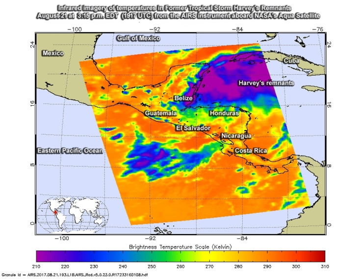
Nasa's Jet Propulsion Laboratory (JPL) released infrared images of the storm on 22 August. Cloud top temperatures were reported to be as cold as -53 degrees Celsius. Nasa said that "storms with cloud tops that cold are high up in the troposphere and can generate heavy rainfall".
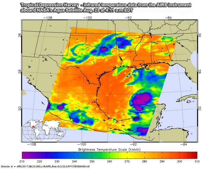
23 August saw the rebirth of Harvey, becoming a tropical depression off the Gulf of Mexico.
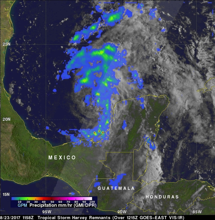
Nasa collected data from the Global Precipitation Measurement mission (GPM) satellite-based observatory that flew over the cyclone and collected data on its microwave imaging tools where a feeder band from the south was causing rainfall at a rate of over 50mm per hour.
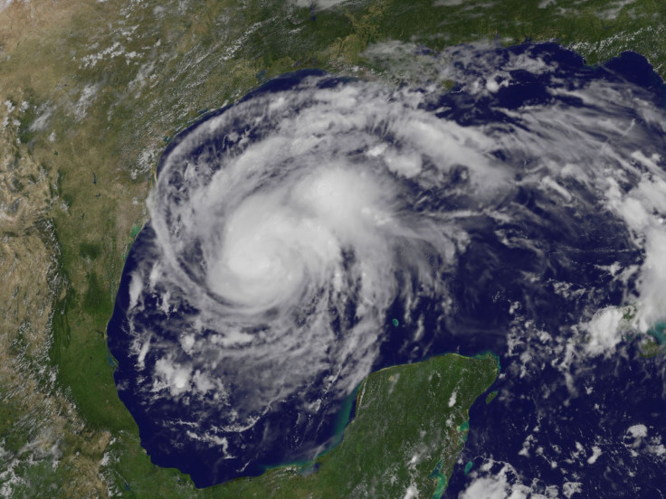
Harvey grew stronger as it started to move from Mexico's Yucatan Peninsula into the Bay of Campeche. It is said that warm waters off the Gulf of Mexico created favourable conditions for the storm to intensify because of the vertical wind shear it faced in the gulf.
At this point, the NHC issued freshwater flood warnings and forecast a major hurricane.
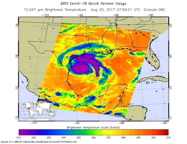
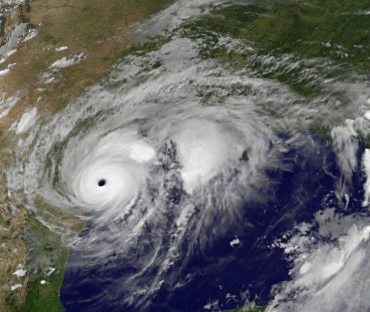
Infrared images captured by Nasa show the storm that intensified by 25 August.
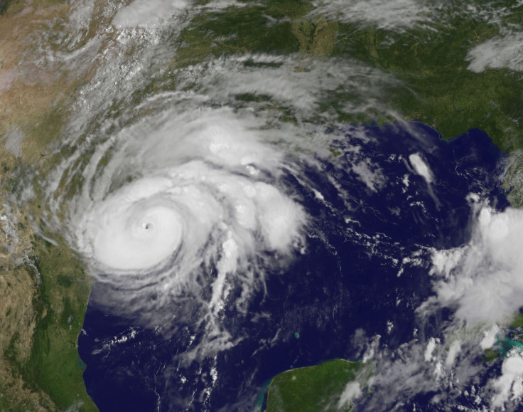
Harvey is seen progressing toward the coast of Texas. This image from Nasa clearly shows the "eye of the storm".
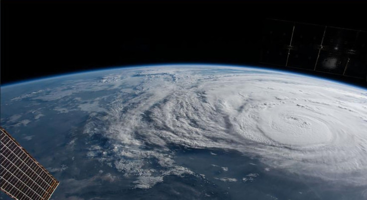
This video captured from the space station provides a view directly over Harvey on 25 August.
Harvey as seen from the ISS shows the extent and severity of the storm.
Nasa reported that once the storm made landfall, it was expected to cause "catastrophic flooding across parts of Texas".
Harvey makes landfall on 26 August, reports Nasa
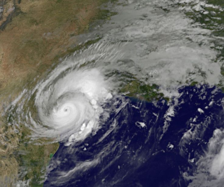
By evening on 26 August, Nasa reported that the intensity of the storm had decreased and that wind speeds fell to about 100 kmph and that there was little movement of the storm itself. Harvey's centre, at the time was reported to be around 70 km north-west of Victoria, Texas, and was not expected to move much.
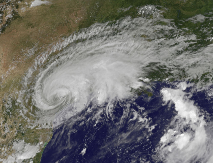
Harvey weakened to a category 1 storm, with the eye disappearing, but heavy rainfall was expected to continue for a few more days, reports Nasa.
“Houston, we have a hurricane.†Our thoughts & prayers are with folks feeling Harvey’s wrath, as dawn breaks after a long night of rain. pic.twitter.com/XR1RvZpkrD
— Jack Fischer (@Astro2fish) August 26, 2017
IBTimes UK is providing regular updates on Hurricane Harvey.
© Copyright IBTimes 2025. All rights reserved.
- MOST READ


