

Nasa: Most detailed map of Mars' gravity helps solve Red Planet mysteries

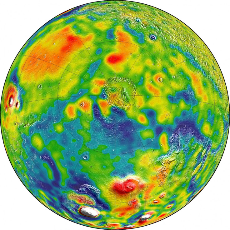
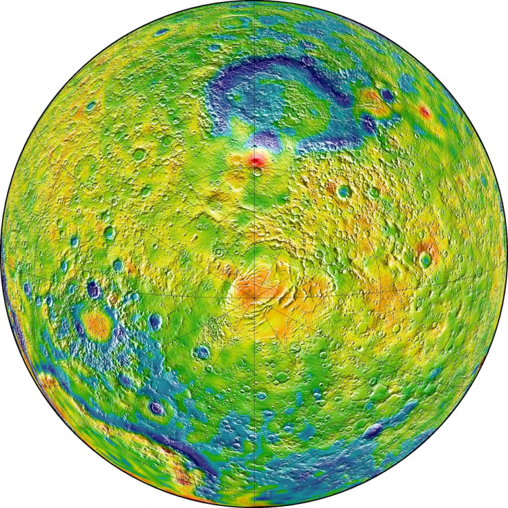
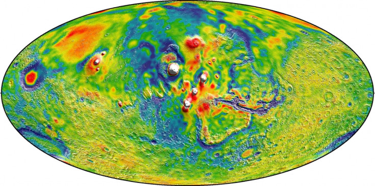
The most detailed map of Mars' gravity has been released, using the planet's gravity to indicate contours and curves on the surface. The map also allows scientists to see inside the planet to investigate its core.
The research, published in Icarus, explains how some features of the planet formed in its early life, as the map shows how the thickness of the crust changed over time. Also, better understanding the planet's gravity will also help spaceships to enter orbit easier.
"Gravity maps allow us to see inside a planet, just as a doctor uses an X-ray to see inside a patient," said Antonio Genova, lead author of the report from the Massachusetts Institute of Technology.
The map was made by using 16 years of data from three separate Nasa spacecrafts – Mars Global Surveyor, Mars Odyssey, and Mars Reconnaissance Orbiter. The data was collected by analysing the orbit of these spacecrafts. Their distance to the surface would slightly fluctuate dependent on gravity. For example, a tall mountain would ever so slightly push the spacecraft away. Likewise, a deep crater would draw it in.
Experts used this information to generate a map showing the changes in the surface across the entire planet. In the maps, the red areas show mountainous, hilly regions on the surface, whilst the blue areas show relatively low-lying areas. Therefore, in terms of the planet's gravity, the spacecraft would move closer to the surface in the blue areas, and move slightly further away in the red.
This information has been used to determine features of the planet that were not previously understood. That includes the region between the flat northern plains and the southern bumpy highlands. This region was believed to be a series of underground channels which transported water between the north and south in the planet's early existence. The maps have revealed these tunnels were a lot wider than previously believed.
They also managed identify the characteristics of the planet's core. They used information about the Sun and Mars' moons gravitational pull to confirm the planet's outer core is made from liquid molten rock – similar to Earth.
Finally, the researchers were able to use the map to discover three to four trillion tonnes of carbon dioxide is pulled out of the atmosphere every winter. This carbon dioxide becomes so cold, that it freezes solid and forms giant polar ice caps.
"With this new map, we've been able to see gravity anomalies as small as about 100 kilometres (about 62 miles) across, and we've determined the crustal thickness of Mars with a resolution of around 120 kilometres (almost 75 miles)," said Genova. "The better resolution of the new map helps interpret how the crust of the planet changed over Mars' history in many regions."
© Copyright IBTimes 2025. All rights reserved.
- MOST READ


