Did New Jersey's Flood Risk Notifications Fail? Is New York Now At Risk?
Many in New Jersey were caught off guard despite flood alerts
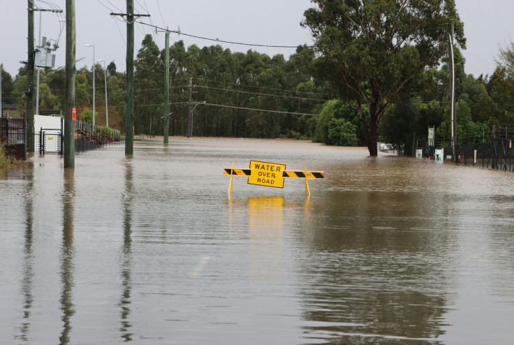
On Sunday, 14 July, flash flooding hit large parts of New Jersey, displacing residents, submerging roads and paralysing public transport, after a slow-moving storm system dumped several inches of rain within hours.
The state's emergency response was overwhelmed, prompting Governor Phil Murphy to declare a state of emergency late in the evening. Questions have now been raised about how effectively flood risk notifications were delivered to the public as the storm unfolded.
Areas Worst Hit by Sudden Downpour
According to multiple reports, the flash floods hit hardest in Union County, including North Plainfield, Roselle Park and Scotch Plains. Route 22 was left submerged, and dramatic scenes emerged showing commuters stranded in buses and vans. Parts of the New Jersey Turnpike were completely underwater.
Some areas recorded between three and six inches of rain in just a few hours, with rainfall rates reaching up to two inches per hour. The sheer volume overwhelmed drainage systems, leading to rapid water accumulation in low-lying areas.
Public transport was severely disrupted, with New Jersey Transit trains suspended and major delays reported across subway and bus routes. Newark Liberty International Airport also issued ground stops, affecting dozens of flights.
Flood Warning System Criticised
A Yahoo News article covering the New Jersey flash flooding noted that while 'warnings had been issued days and hours before floodwaters began carrying away homes, and lives,' residents still 'were seemingly caught off guard.'
Emergency services were stretched thin, carrying out dozens of water rescues in homes and vehicles. North Plainfield's mayor confirmed that several homes were evacuated as emergency crews worked through the night.
Experts Point to Gaps in Flood Preparedness
Meteorologists say the disaster was driven by a slow-moving moisture-laden front that stalled over the Northeast corridor. While the event was extreme, experts argue it highlights critical weaknesses in New Jersey's flood preparedness and warning infrastructure.
Experts note that flash floods are extremely hard to forecast, but they stress that flood‑alert systems must operate effectively even under significant stress, otherwise the warnings serve no purpose.
Some local officials have acknowledged the shortcomings and called for a full review of the state's emergency response framework.
Outdated Infrastructure Exacerbates Flood Risk
Experts warn that aging drainage systems in both New Jersey and New York are ill-equipped for modern climate extremes. New Jersey received a D for stormwater management in the 2025 ASCE Infrastructure Report Card, while much of New York City still relies on a combined sewer system prone to overflow. Despite recent federal funding, implementation of critical upgrades remains slow compared to the increasing frequency of flash flood events.
Is New York Next?
New York City narrowly escaped the worst of the storm but still faced flash flood warnings and public transport delays. The Cross Bronx Expressway and parts of the subway system were briefly affected.
With another wave of storms forecast later this week, experts are warning that New York could face similar issues if drainage systems and flood alerts are not fully operational.
The city's densely populated boroughs and ageing infrastructure remain vulnerable to sudden flooding. Climate resilience and real-time notification systems will be critical in protecting lives and property in future events.
© Copyright IBTimes 2025. All rights reserved.
- MOST POPULAR IN World