

Ancient civilisation may have risen along Indus Valley river 3,000 years after it dried up
According to a recent study, the Sutlej River disappeared long before the ancient cities were built.

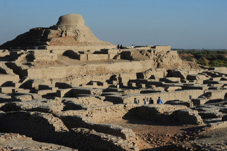
The Indus Valley Civilisation is recognised as one of the oldest in the world, rivalling those in Egypt and Mesopotamia. Spread across three countries — northeast Afghanistan, Pakistan and northwest India, the ancient culture flourished in the region along the Indus River and its tributaries.
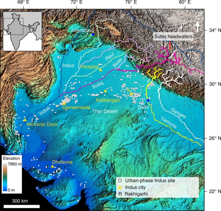
A major part of this civilisation was thought to have risen along the banks of the Sutlej River, but a new study published in Nature Communications suggests that might not be the case. Based on satellite imagery, researchers were able to map the course of the Indus tributary and confirmed that it did flow through the riverbed the civilisation flourished along.
However, on dating the sediments in the channel left by the river (known as the Ghaggar-Hakra palaeo-channel), they discovered that the water body had dried up or changed its course over 8,000 years ago. This would suggest that the Indus Valley civilisation, which rose to prominence 5,300 to 3,300 years ago, could not have banked on the river for water supply since it was no longer flowing in that region.
The other two Old World civilisations in Egypt and Mesopotamia were both situated along the banks of major rivers, in order to harness water and use the water body as a means of transport. Even today, some of the biggest cities have water bodies bordering them.
The idea that the early Indus settlers in Asia did not have easy access to a large amount of water supply raises a lot of new questions. These people were recognised as pioneers in the use of bronze and would have needed water for their metallurgy. They also engaged in agriculture and would have required water to grow crops.
It was thought that the disappearance of the Sutlej was responsible for the end of the civilisation, but Rajiv Sinha, the author of the study, believes that it was the change in course of the large river that caused the people to build their cities on a dried-up riverbed.
"Some of their sites were actually built in the palaeo-channel itself and that makes no sense if there was a big raging Himalayan river there at the time because these people would have been wiped out," the Imperial College professor explained.
"Our paper clearly demolishes the age-old river-culture hypothesis that assumed that the disappearance of the river triggered the demise of the Harappan civilisation," he added. "We have argued that while large rivers have important connections with ancient societies, it is their departure that controls their stabilisation rather than their arrival."
Sinha believes that the Indus people would have made use of rain water that flowed through the old river channel or could have engineered ways to tap ground water.
While the new theories could hold ground, Prof Rita Wright, an anthropologist at New York University, pointed out that it refers to only one particular region of the widespread civilisation. Other cities were based along various other rivers much like their Egyptian and Mesopotamian counterparts.
"It is focused primarily on a single area in northwest India, [but] enormously important," she told the BBC. "In contrast to the Indus Valley, it presents (and provides evidence for) a very different water ecology. No denying that water was one of the major resources in the Indus, so here we have evidence for significant differences between the Indus valley alluvial plain and the Ghaggar monsoon-driven water system."
- MOST READ


