Ben Nevis: Britain's tallest mountain is suddenly 1 metre higher
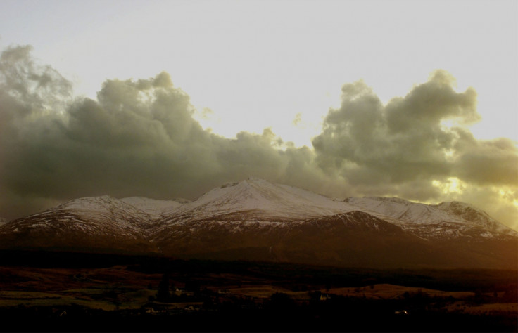
The height of Britain's tallest peak has increased by 1m. The Ben Nevis mountain now stands at 1,345m and not 1,344m as previously measured. The new official height is not the result of any geological phenomenon, but more accurate measurement, courtesy modern technology.
The mountain was last measured in 1949, but the new measurement carried out by the British Ordnance Survey (OS) with the help of GPS technology revealed a difference of about a metre. The actual height calculated by the OS team was 1,344.527m, a difference of only a few centimetres from the 1949 figure.
However, the new figure allowed the surveyors to round up the final number rather than rounding it down and thus, the official height of the peak is now 1,345m. OS is already issuing new maps with the updated height of the peak, BBC reported.
When Ben Nevis was last measured 67 years ago, a team had to climb up the peak carrying heavy equipment. The measurement process took almost three weeks back then. The peak's official measuring point is a "trig pillar", which rests on a cairn atop the mountain. To measure the peak's height, theodolites, instruments for measuring angles on horizontal and vertical planes, used to be positioned on the trig pillars to find out the elevations.
The trig pillar atop Ben Nevis was recently restored after which the OS team calculated the height of the peak again. Scientists today use GPS, which gives a location by using the atomic clocks flown aboard a constellation of satellites as reference. Scientists get the actual height by processing that data.
Mark Greaves, geodetic consultant at OS, explained that "errors in the signals coming down from the satellites" can affect GPS readings and thus, GPS in the mobile phones "can be out by several metres." He added that the incorrect data is filtered out by comparing the data they get from the mountain peak with "highly accurate, permanent GPS stations nearby. And if you do it to a high enough degree with some very sophisticated software, you get down to centimetres and better."
© Copyright IBTimes 2025. All rights reserved.
- MOST POPULAR IN Science