

Hurricane Humberto Will Hit the UK on This Day — Here's When and Where Storm Amy Will Strike
Wind speeds of up to 70mph could sweep through more than 40 cities
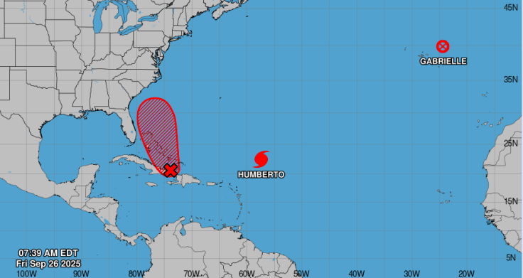
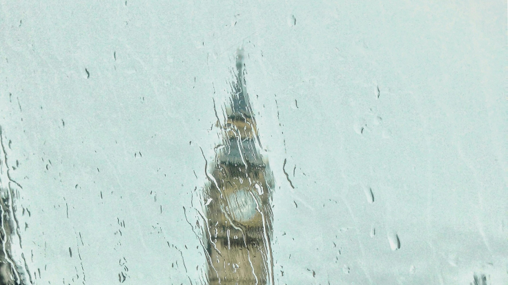
Britain is bracing for a turbulent weekend as the remnants of Hurricane Humberto barrel across the Atlantic, with forecasters warning that the storm could unleash winds of up to 70–80 mph.
The system, which sideswiped Bermuda earlier this week, is on track to merge with another Atlantic low before striking the UK, where it is expected to be named Storm Amy. Meteorologists predict that the worst conditions will arrive by Friday night into Saturday, bringing widespread gales, torrential rain, and travel disruptions across large parts of the country.
When Will Storm Amy Hit the UK?
According to AccuWeather forecasters, the post-tropical remnant of Humberto is expected to arrive late Friday or Saturday, bringing strong winds, heavy rain, and widespread travel disruptions across the British Isles. They project gusts of 70-80 mph in exposed areas, particularly in northwestern England, Wales, Scotland, and along the coast of Ireland.
The storm is expected to blend with a deepening Atlantic low, transforming into a large-scale extratropical system that could retain its intensity at landfall. The worst conditions are forecast for the western and northern parts, where orographic uplift might enhance rainfall and wind.
ITV reports that if the storm is named 'Amy,' it may deliver 50-60 mph winds, with isolated gusts up to 80 mph in worst-case scenarios. Meanwhile, the Met Office is actively monitoring the system and could issue weather warnings if confidence improves.
More Than 40 Cities to Face Impact
Meteorologists warn that once Humberto transitions into Storm Amy, it could bring severe gales and heavy rainfall across much of the UK. Forecast models from WXCharts and the Met Office suggest wind speeds of up to 70mph could sweep through more than 40 cities.
According to experts areas most at risk include Manchester, Sheffield, Stoke-on-Trent, Derby, Nottingham, Leicester, Shrewsbury, Wolverhampton, Leeds, Bradford, Birmingham, Peterborough, Norwich, Cambridge, Coventry, Stratford-upon-Avon, Gloucester, Oxford, Luton, London, Reading, Canterbury, Southend-on-Sea, Bristol, Bath, Southampton, Bournemouth, Exeter, Plymouth, Portsmouth, Brighton, Hastings, Dover, Hereford, Carlisle, Workington, Middlesbrough, Sunderland, York and Newcastle upon Tyne.
⚠️ Yellow weather warning issued ⚠️
— Met Office (@metoffice) September 29, 2025
Rain across western Scotland
Wednesday 1700 – Friday 0600
Latest info 👉 https://t.co/QwDLMfRBfs
Stay #WeatherAware⚠️ pic.twitter.com/xx6pxIzlmL
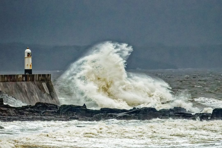
Experts note that while the north and west are likely to face the strongest gusts, even southern and coastal areas could experience travel disruptions, power cuts, and localised flooding as the storm peaks between Friday night and Saturday afternoon.
Flooding, Travel Chaos and Safety Risks
Forecasters are bracing for widespread disruption. AccuWeather estimates that parts of western Scotland, northwest England and north Wales could see up to 50 millimetres (2 inches) of rain, with some areas hit by 100 millimetres (4 inches). Flash flooding, road closures and dangerous travel conditions are reportedly possible.
Meanwhile, airlines and ferry services are also expected to face cancellations and delays if the wind and rain situation escalates. With winds expected to peak at 70–80 mph in exposed regions, falling trees, power outages and damage to coastal defences are likely.
The Met Office stressed the uncertainty in the exact path but reinforced the risk of severe conditions. 'If this materialises, we could see some very strong winds as well as further heavy rainfall Friday into Saturday, but at this time the development and track of this system remains uncertain,' it said in its latest forecast.
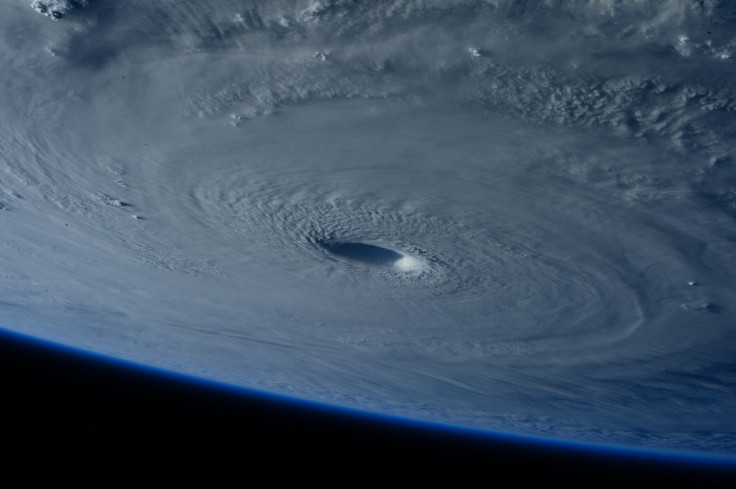
Meanwhile in the US, reports suggest that Hurricane Humberto remains a powerful Category 4 hurricane according to latest forecast. With hurricane activity in the Atlantic running above average this year, Britain may face further threats in the weeks ahead.
© Copyright IBTimes 2025. All rights reserved.
- MOST POPULAR IN National


