

New Map of World's Seafloor Brings Alive Mysteries of the Deep

Mysteries of the deep, least-explored parts of our planet have been brought to life with a new map of the world's seafloor.
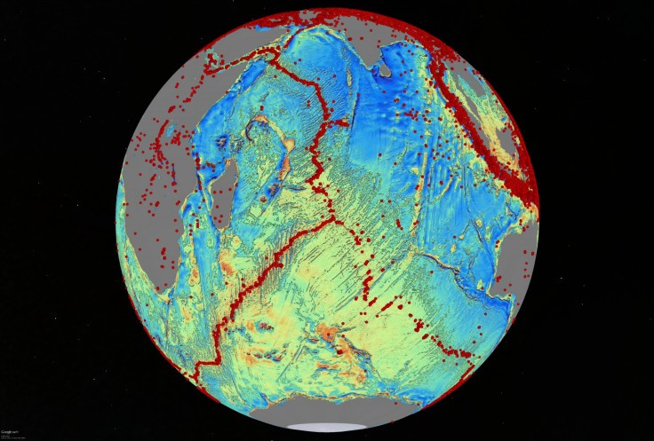
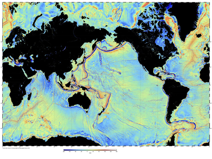
The map, created by scientists at Scripps Institution of Oceanography at UC San Diego, shows thousands of previously uncharted seamounts rising from the bottom of the ocean to over a kilometre in height.
Described in Science, the map was created using previously untapped streams of satellite data.
As well as sea mounts, the team also mapped earthquakes and found a link between the two. Most seamounts were once active volcanoes, so are normally found near tectonically active plate boundaries, mid-ocean ridges and subducting zones.
The authors believe their map could provide clues about the formation of the continents, providing a window into the tectonics of deep oceans.
Features exposed by the map include continental connections across South America and Africa.They also found an underwater ridge in the northern Indian Ocean more than 8km thick, which was made up from the remains of rock washed from the high Himalayas.
"One of the most important uses will be to improve the estimates of seafloor depth in the 80% of the oceans that remain uncharted or [where the sea floor] is buried beneath thick sediment," the authors state.
Lead scientist David Sandwell added: "The kinds of things you can see very clearly now are abyssal hills, which are the most common land form on the planet."
That map used data from the European Space Agency's CryoSat-2 satellite, which is normally used to capture polar ice data, but also monitors oceans continually. It also used Nasa data from the Jason-1 satellite, which was redirected to map the gravity field over the last year of its 12-year mission.
"The team has developed and proved a powerful new tool for high-resolution exploration of regional seafloor structure and geophysical processes," said Don Rice, programme director in the National Science Foundation's Division of Ocean Sciences, which funded the research.
"This capability will allow us to revisit unsolved questions and to pinpoint where to focus future exploratory work."
Researchers say the map provides a foundation for the new version of Google maps, as well as providing location information on seamounts, improving safety for the US navy.
© Copyright IBTimes 2025. All rights reserved.
- MOST READ


