

Prepare for 'more frequent and intense flooding', warns UK Environment Agency
The Agency seeks to raise awareness in the public as a part of their new Flood Action Campaign.
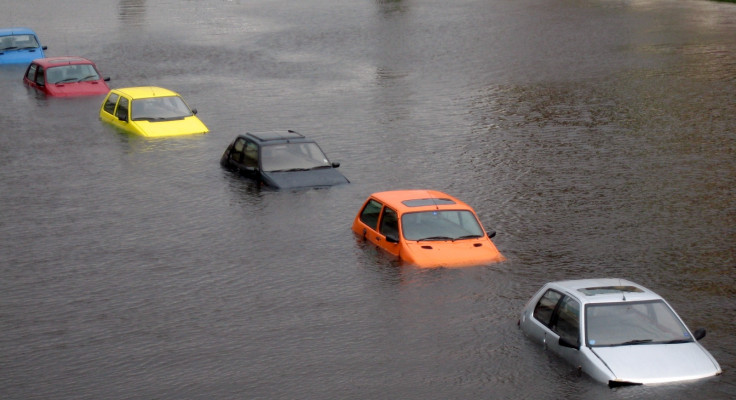
Several parts of United Kingdom are expected to see increased bouts of flooding due to climate change, the Environment Agency has said. The warning follows a study by the Met Office on UK weather data over the past decade.
The Agency launched the Flood Action Campaign last week to raise awareness among the younger population of the country. As per the estimation featured in the campaign, up to 5.2 million properties are at risk of flooding in England alone.
The campaign provides information on signing up for free warnings, how to react in the event of a flood, checking the flood risk levels in an area and other such online resources.
Apart from warnings against taking 'storm selfies', the website also advised against driving through water as it was "the number one cause of death during flooding".
"Climate change is likely to mean more frequent and intense flooding. Floods destroy — lives, livelihoods, and property," said Sir James Bevan, Chief Executive of the Environment Agency.
"Our flood defences reduce the risk of flooding, and our flood warnings help keep communities safe when it threatens. But we can never entirely eliminate the risk of flooding. Checking your flood risk is the first step to protecting yourself, your loved ones and your home."
The statement revealed a series of statistics, explaining how the past ten years have seen a pattern of increased weather events.
For instance, Met Office records have listed 17 record breaking rainfall months or seasons since 1910 where nine of them have occurred since 2000. During the winter of 2015-16, widespread flooding affected 17,000 properties across Northern England.
Due to this event, December 2015 went on to be recorded as the wettest month in the history of the UK. More recently, in January 2018, heavy rains and flooding caused major problems in North Devon.
Professor Adam Scaife, who leads the research at the Met Office, explained how the risk of a flooding event in calculated through the creation of simulations.
"The Met Office supercomputer was used to simulate thousands of possible winters, some of them much more extreme than we've yet witnessed. This gave many more extreme events than have happened in the real world, helping us work out how severe things could get," he said.
- MOST READ


