

The curious case of Google Maps in China: Why is it so inaccurate?
Google Maps data for China is slightly off due to the country's numerous border disputes with other nations.

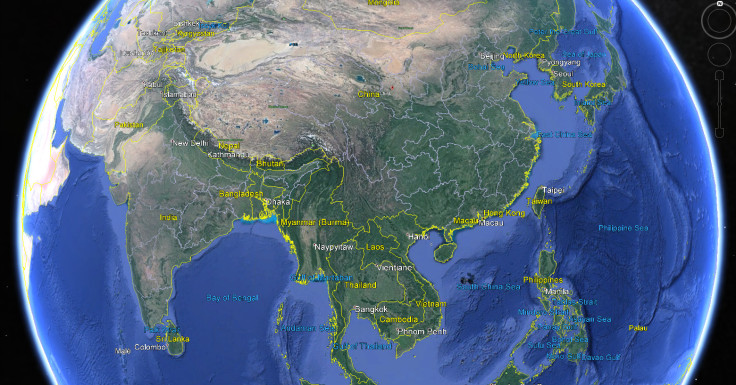
If a whim takes you to look at China's geography online, you'd be better off avoiding Google Maps, because the information is likely to be slightly off. A river that appears out of nowhere, a border between India and China that is completely different on Indian and world maps, or simply roads that just don't seem to where they should be.
You would think that getting a map right would be a piece of cake today with satellite GPS systems and the advent of Google Earth, but for once, the problem has nothing to do with the internet giant.
The reason why maps of China are so odd is because the Chinese government considers geographic information about the People's Republic of China to be a matter of national security, so private surveying and mapping activities are illegal in mainland China and have been since 2002.
If anyone wants to publish any geographic data concerning the country's air, land and waters, or data relating to any territories that the Chinese government feels is under its jurisdiction, then they must first obtain permission or they will be punished with a fine.
In fact, over the last eight years China has fought at least 40 cases of illegal mapping and surveying and issued fines against everyone from Japanese and Korean academic researchers to UK geology students from Imperial College London and all the way up to massive conglomerates like Coca Cola.
To that end, if you take your snazzy new digital camera to China and take a picture, when you look at the photo's metadata, you will find almost no location information available, and the only way that any online map provider can have a complete map of China is if they agree to host the data on servers inside China, and if they agree to use a very specific coordinate system.
Deliberately inaccurate state-approved coordinate systems
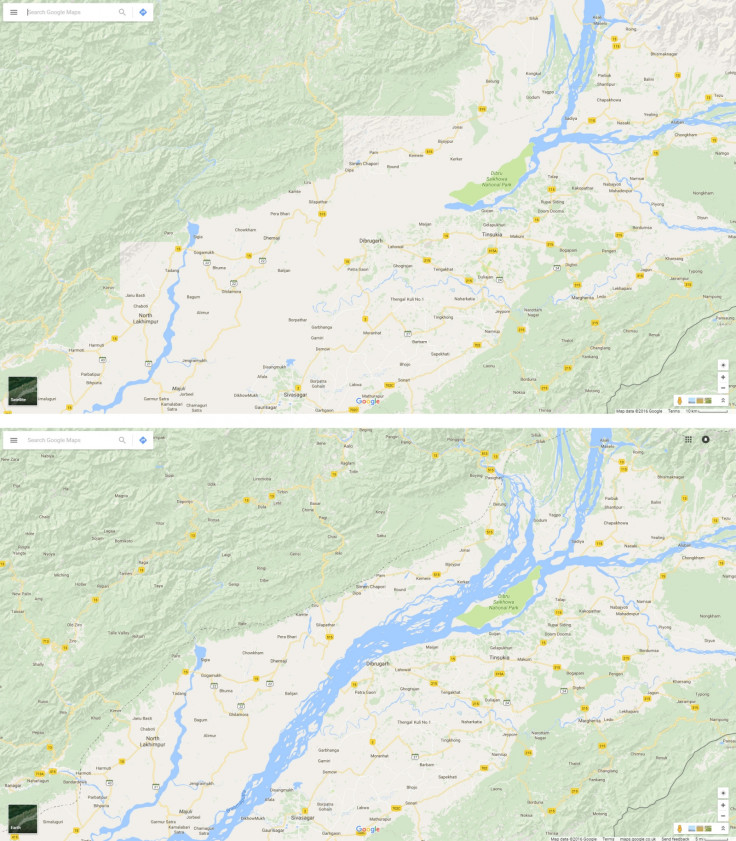
Digital map services in China use a very specific coordinate system called a geodetic datum that has been specially formulated by the Chinese State Bureau of Surveying and Mapping called GCJ-02. What this means is that an encryption algorithm has been added to the maps to add random offsets to both the correct altitude and longitude of any geographic coordinates.
So if you were to look at a Google street map for a specific place in mainland China, the coordinates of the map are offset by between 50-500m away from reality. This doesn't mean that maps are inaccurate within China and that people are constantly walking around scratching their heads however – it's just inaccurate if you look at it from outside the country, the local street map would be accurate, and this is the same with Yahoo Maps as well.
And it isn't just restricted to urban and rural areas in the country. If you zoom out and look at the territory of China as a whole, the borders between China and other nations also differ from the same borders details on other maps, such as the crowdsourced OpenStreetMap, which publishes correct coordinates in direct opposition to the government's mandate.
That's my territory, not yours
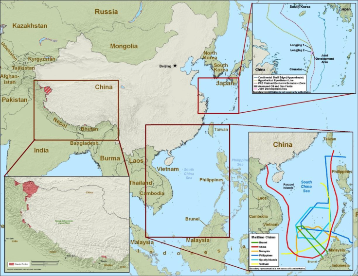
China is currently involved in disputes with eight countries about 14 territories over its correct territorial boundaries, the most of any country in the world, and so the Chinese government is also touchy about any maps that don't reflect the boundaries that it believes in.
In fact, as pointed out by statistical blog Metrocosm, if you were to look at the Chinese version of a map of south-east Asia, it looks like China owns pretty much all of the South China Sea, including almost all of the waters around Malaysia, Vietnam and the Philippines, which affects a number of disputed islands, such as the Scarborough Shoal, which the Philippines maintains belongs to them.
Google already has enough trouble with dealing with China over its search engine, so mapping is clearly not an area that it wants to go to battle with the Chinese government over, but following numerous complaints by Filipinos, Google did cave in 2015. China calls the landmass Huangyan Island, while the Philippines knows it as the Panatag Shoal.
To avoid legitimising either country's claims, Google changed the maps to remove the Chinese name and instead renamed the island Scarborough Shoal, which is its international name.
© Copyright IBTimes 2025. All rights reserved.
- MOST READ


