

Huge 130m-wide waterfall is largest ever discovered in Antarctica
Waterfall is formed from meltwater from a network of lakes and streams across the ice sheets.

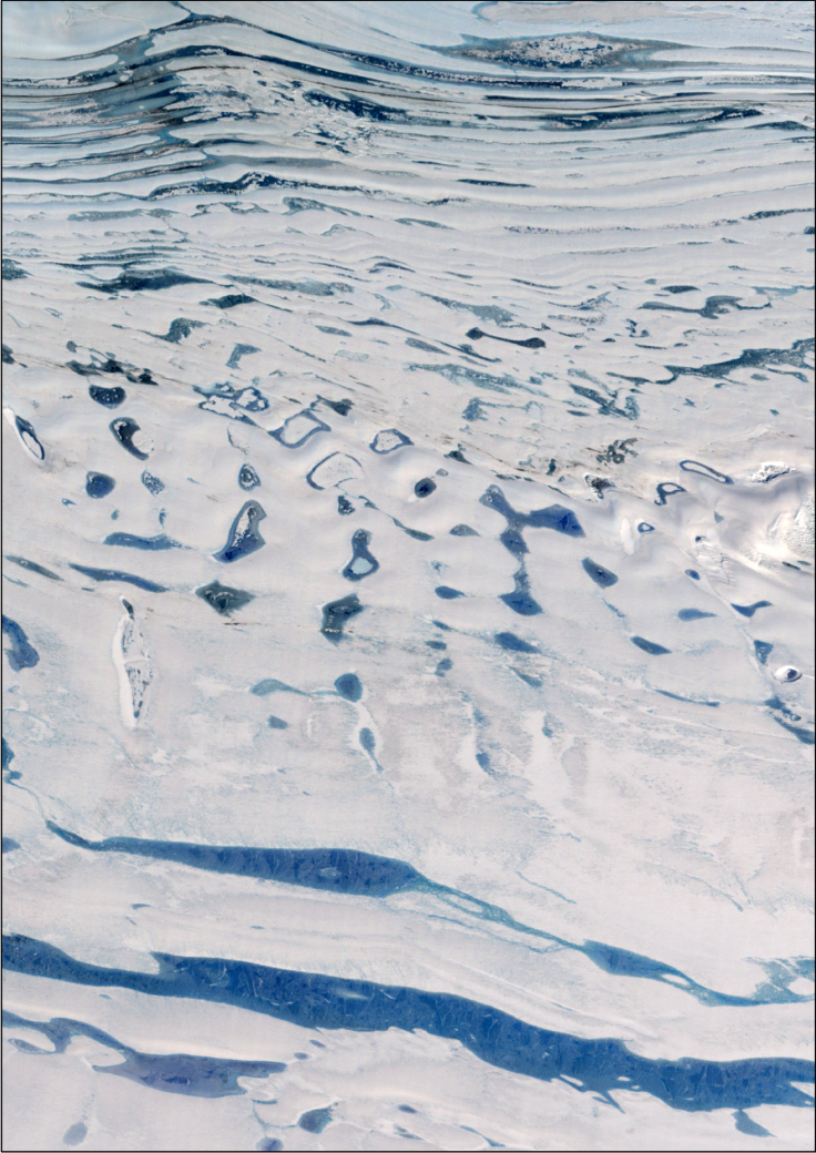
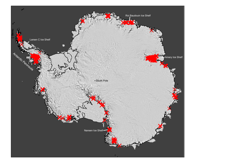
A large network of streams, lakes and waterfalls on the ice shelves that cover Antarctica has been discovered by piecing together historic satellite and aerial imagery. Some of the newly identified watercourses are more than 70 years old.
These lakes can weaken the ice sheet by adding pressure, deforming it and causing it to crack. Streams and lakes were thought to be a very rare occurrence on the Antarctic ice sheets, so the presence of many long-established watercourses could mean the ice sheets are more vulnerable to collapse than previously thought.
"Surface meltwater drains across ice sheets, forming melt ponds that can trigger ice-shelf collapse, acceleration of grounded ice flow and increased sea-level rise," write the authors of a paper published in the journal Nature.
To map where the water was and how it was moving, researchers compiled satellite images of the continent from 1973 onwards and aerial photographs from 1947 onwards. For something that has eluded scientists for at least 70 years in some cases, these features are on an incredible scale.
"Surface drainage has persisted for decades, transporting water up to 120 kilometres from grounded ice onto and across ice shelves, feeding vast melt ponds up to 80 km long," the authors write.
But it's not known exactly how much this is likely to affect the stability of the ice sheet. In some cases, the meltwater isn't staying put, where it can put pressure on the ice sheet, but is instead flowing away in rivers. These rivers could be a blessing in disguise, whisking away this excess water before it causes a strain on the ice sheet, write the authors of a second paper in the same issue of Nature.
"This newly discovered plumbing system has the potential to buffer the impact of warming air temperatures," study author Robin Bell of Colombia University in the US told IBTimes UK. This could alleviate the stress of the meltwater, but not cancel it out entirely, she said.
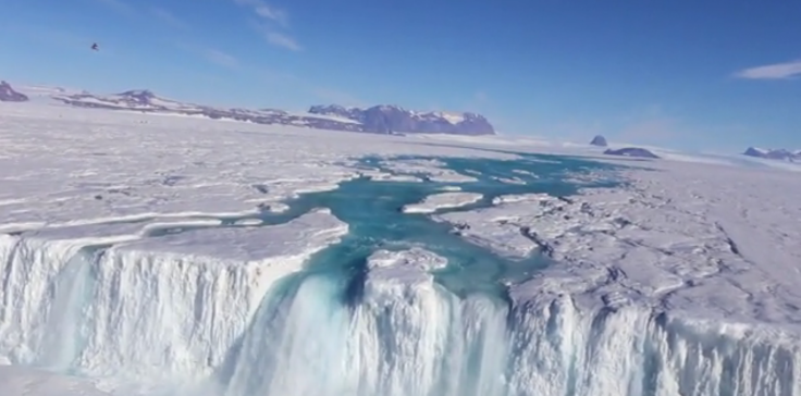
The large rivers flowing across ice shelves can be extremely efficient. One of the newly discovered rivers ended in a particularly huge waterfall.
"The surface river terminates in a 130-metre-wide waterfall that can export the entire annual surface melt over the course of seven days," the study says.
That's about 20% of the size of Niagara Falls – fairly large for something missed by decades of expeditions and aerial investigation of Antarctica.
The new discoveries raise many questions about the stability of Antarctica's ice sheets. Are the extensive meltwater pools a sign that the ice sheets are closer to collapse than we thought? Or do the presence of the huge drainage rivers show that the ice sheet has mechanisms to cancel out or at least alleviate this instability?
Research on the finer points of the play of surface water on the ice sheet will help to answer these questions, writes Alison Banwell of the Scott Polar Research Institute at the University of Cambridge in a comment piece in the same issue of the journal.
"Given that the Antarctic Ice Sheet contains enough ice to raise global sea levels by 60 metres, identifying and quantifying the role of all surface and subsurface processes on the potential stability of ice shelves is becoming increasingly important," she writes.
© Copyright IBTimes 2025. All rights reserved.
- MOST READ


