

Mysterious walls of 700-year-old abandoned city were built to work with nature - not against it
The vanished farmers of Engaruka manipulated the river to benefit their crops.

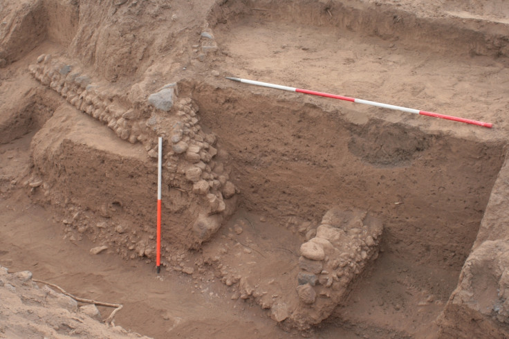
Deep walls in the land around the abandoned city of Engaruka, modern-day Tanzania, were built to guide the river through the fields and deposit sediment where it was needed to nourish crops, archaeologists have discovered.
Engaruka was first discovered in 1935. It had previously been home to about 40,000 people, but had been abandoned for at least 200 years by the time it was found, and had been occupied continuously for 500 years before that.
Exactly what made the people of Engaruka abandon their site is not known. But archaeologists have been working at the site to find out more about the people who lived there in the hope of shedding light on this.
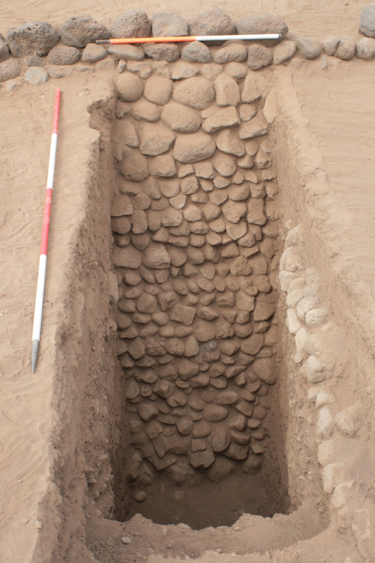
The farmers of Engaruka had a sophisticated system of irrigation that helped divert sediment from the river flowing past the city, according to a study in Quaternary Research. Previously it was supposed that the walls – which reach 3 metres in depth at some points – were built to prevent soil erosion from the settlement.
The city sits on an alluvial fan at the bottom of Africa's Great Rift Valley. The river would frequently flood the fields around the city during periods of heavy rain.
"The waters were channelled off these rivers through stone-lined canals, and then channelled into the fields," study author Carol Lang of the University of York told IBTimes UK.
The walls would retain the sediment, and in front of the wall was an irrigation canal to feed the field in front. As the river would come and flood the region, directed by the walls, it would deposit rich sediment for the crops. Over successive years, the land level would rise, and the walls would be built higher.
"We see the walls weren't built in one stage. When we excavate the site, these walls are revealed in their totality," Lang said. "But the people who engineered the irrigation system never actually saw these walls totally at all."
It's possible that the walls could have redirected the flow of the river and sent the water to the fields that needed it most. But without seeing the system in action, it's impossible to say this for certain.
"It just highlights the engineering feat that these hectares have seen. It's quite astounding," Lang said.
The walls themselves show that throughout the 500 years the settlement was occupied, people employed different strategies to manage them.
"The site was occupied from the 14th century through to just prior to when the colonials came into the area," Lang said.
"We could see there were obviously different management techniques undertaken within the soils. It suggests that over periods of time they've had to change the techniques due to variability within climate."
It's not clear whether a changing climate had anything to do with the Engaruka people's abandonment of the city. There is no oral history from today's occupants of the area, the Maasai herders, relating to the original occupants.
"If the Maasai had come into the area and there were inhabitants there already, they would have said. There's a necessity for more studies to understand why this abandonment happened."
© Copyright IBTimes 2025. All rights reserved.
- MOST READ


