

Bolivia's vanishing Lake Poopó: ESA images show fully evaporated lake from space

Bolivia's second-largest lake, Poopó, was declared fully evaporated in December 2015. Satellite images released from the European Space Agency (ESA) have now shown the lake vanishing over the course of three years, from April 2014 to January 2016.
The blue regions in the above images, taken by the Proba-V mini-satellite, show the dried-up salt flats in the southern part of the lake. The evaporation has been linked with the use of the lake's water sources for mining and agriculture. This has been coupled with persistent drought linked with El Niño warming in the Pacific Ocean, as well as global climate change.
"Occupying a depression in the Altiplano mountains, the saline Lake Poopó has in the past spanned an area of 3,000sq km [1,158sq m] – greater than France's Réunion Island," the ESA said in a statement. "But the lake's shallow nature, with an average depth of just three metres, coupled with its arid highland surroundings, means that it is very sensitive to fluctuations in climate."
The last time Lake Poopó evaporated was in 1994, and it took several years before the water returned. Ecosystems took even longer to recover. Some scientists have suggested that the lake may never return.
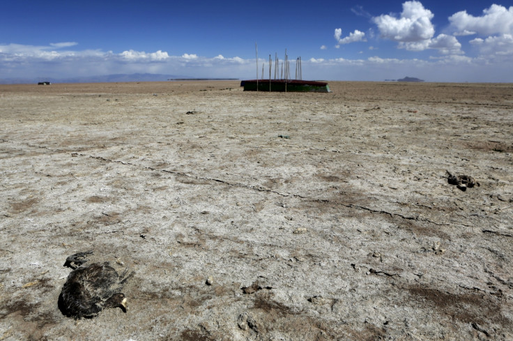
Lake Poopó is an extremely important fishing resource for those living nearby, and since its disappearance many people have been left without livelihoods. New images show the barren landscape, with fishing boats abandoned on the dried-up base. Nasa images released earlier this year also highlighted the state of the lake. A report by AP highlighted major impacts that the disappearance of the lake would have on the country. A study commissioned by the Bolivian government found the lake was not getting enough water to maintain it, with authors concluding this could lead to irreversible changes to the ecosystem, resulting in "massive emigration and greater conflicts".


© Copyright IBTimes 2025. All rights reserved.
- MOST READ


