Isolated Amazon Tribe Survival Monitored With Space Technology Using Satellite Images

Scientists from the University of Missouri at Columbia (MU), Santa Fe Institute and University of New Mexico have been using high-resolution satellite imaging technology to remotely monitor isolated tribes living in the Amazon rainforest in order to assist with their long-term survival.
Their study, entitled Remote Sensing and Conservation of Isolated Indigenous Villages in Amazonia, is published in the journal Royal Society Open Science.
It is estimated that there are between 50 and 100 isolated tribes living in the Amazon today in villages of varying populations, from just 40 people to large growing villages of about 300.
Not being used to modern civilisation, the tribes are constantly threatened by disease and violence as some people try to take their homes away through illegal logging, cattle-ranching, drug running and highway construction.
The team of anthropologists, led by Rob Walker, an assistant professor of anthropology in the College of Arts and Science at MU, realised that they needed to find a way to safely track uncontacted indigenous tribes in a non-invasive way.
Close contact with the tribes has the threat of disease from contact, while flying over the villages using aircraft to collect data was both disruptive and frightening for the tribes.
So the researchers developed a method of tracking the tribes using high-resolution satellite imaging from Google Earth and DigitalGlobe's GeoEye and Worldview satellites.
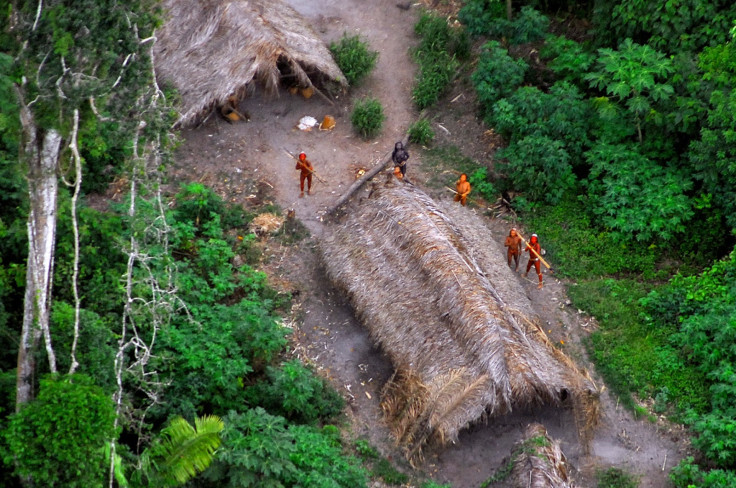
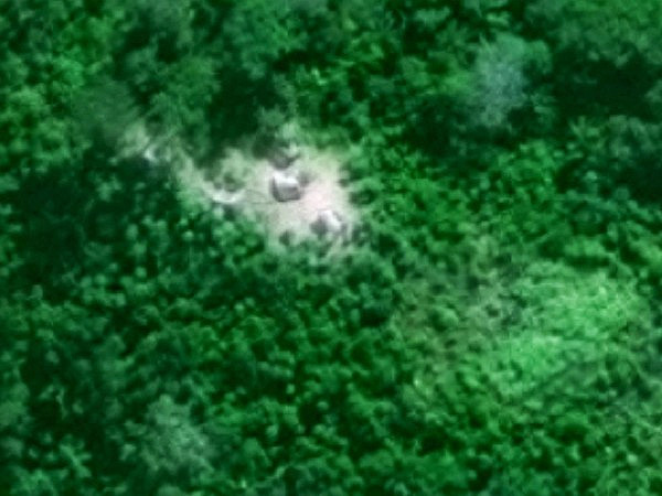
By comparing 50cm-resolution images taken in 2006, 2012 and 2013, the researchers were able to study five isolated villages along the Brazil-Peru border that had previously been identified from flyovers by the Brazilian government and other sources.
It was possible to clearly differentiate the villages from transient camps of illegal loggers and drug runners.
The images were also so detailed that the researchers were able to detect demographic changes by observing evolving patterns in horticultural fields and living dwellings, such as clusters of small houses and traditional Amazonian longhouses.
"Most of these tribes are swidden horticulturalists and so their slash-and-burn fields are observable in satellite images. But, they do move around, sometimes in response to external threats, and this movement requires constant monitoring if there is to be any hope of preserving their habitat and culture," said Walker.
Interestingly, the researchers found that the population densities of the isolated villages were about 10 times greater than that of other villages belonging to indigenous Brazilian peoples who are not isolated.
According to Walker, this could be due to the fact that the isolated tribes do not have sophisticated tools like machetes and axes made from steel, so they are unable to easily clear more space in the forest.
However, he also thinks that the isolated villages could be densely populated as a sort of safety in numbers, whereby the tribes are afraid to spread out their dwellings in case they are attacked by outsiders.
In one 20-year-old village known as Site H, the researchers noted that within just 14 months from May 2012 to July 2013, the tribe living there had cleared an additional 16 hectares (2.47 acres) of forest to make new fields, bringing their total cultivated land area to 28 hectares.
The researchers think that the sudden rapid growth may have been due to new indigenous families fleeing their traditional homes to join the tribe living at Site H, as during the same period, it was noted that loggers and would-be farmers from modern civilisation began moving into the region just 30km away.
The scientists will next begin studying the ecology of 29 more isolated villages, such as the elevation and distance from rivers and roads, in order to figure out where other isolated villages might be located.
© Copyright IBTimes 2025. All rights reserved.
- MOST POPULAR IN Science