

Watch this drone footage of lava spewing from active volcanoes in Guatemala
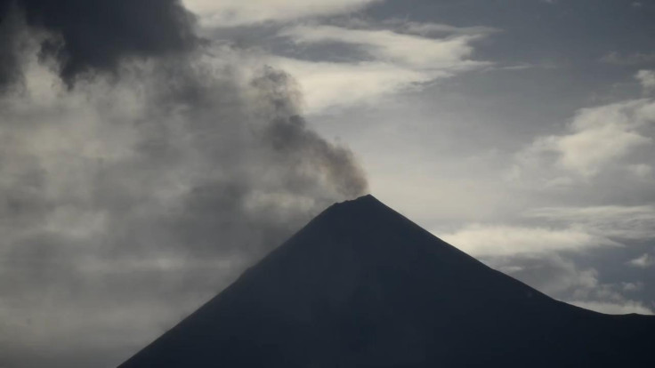
Volcan de Fuego and Volcan de Pacaya are the two volcanoes filmed here.
Studying active volcanoes has been a life threatening task for most volcanologists as getting too close to the lava can be dangerous. However, now drones have not only helped these scientists to better understand volcanoes but also provided some of the most spectacular volcanic eruption views.
Researches from the Universities of Cambridge and Bristol have collected measurements directly from volcanic clouds, with visual and thermal images of inaccessible volcano peaks in Guatemala. The footage below was released by the team showing the two lava-spewing volcanic peaks of Volcan de Fuego and Volcan de Pacaya.
The research team claims it is for the first time when an unmanned aerial vehicle (UAVs) has been used at Fuego, where the lack of close access to the summit has prevented accurate gas measurements. The drones were flown at distances of up to 8 km away from the volcanic tip, and at a height of over 3 km above the launch site.
"These sensors not only help to understand emissions from volcanoes, they could also be used in the future to help alert local communities of impending eruptions—particularly if the flights can be automated," said expedition member Emma Liu, a volcanologist in a statement.
The team plans to return to the site sometime later in the year, with a wider range of sensors including a gas analyser, a four-stage filter pack, carbon stubs for ash sampling, thermal and visual cameras, and atmospheric sensors.
© Copyright IBTimes 2025. All rights reserved.
- MOST READ


