Bogoslof's blast: Alaska's most active volcano spews ash 35,000 feet into air in huge eruption
The aviation colour code was raised to red following the 55-minute eruption.
The Bogoslof volcano in the Aleutian Islands in Alaska erupted on 28 May, sending ash clouds as far as 35,000ft up in the sky. The eruption resulted in the Aviation Color Code to be raised to red, the highest possible level by the Alaska Volcano Observatory.
The volcano has been active for almost six months now, and the eruption took place at 2.16 pm local time and lasted for a total of 55 minutes. Although the aviation alert code has been lowered to orange, the second highest level, now, a red warning for a volcanic eruption means flights could be grounded for several days until the ash is totally clears off the skies.
Ash from volcanoes can harm and even completely halt jet engines when it rises above 20,000ft. So far, however, there are no reports of any flight delays from the eruption.
Ash from the Sangeang Api volcano in Indonesia grounded all flights from Australia and south east Asia in 2014. In 2010, volcanic ash from the Eyjafjallajökull in Iceland resulted in the largest air-traffic shutdown since World War II.
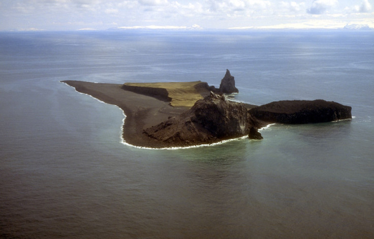
Bogoslof volcano is a submarine stratovolcano, and the size of the island has more than tripled in size as a result of frequent eruptions in the last six months.
The first of these eruptions took place on December 20, 2016, producing towering volcanic ash clouds and changing the geography of the island. The last major eruption occurred on 17 May, sending ash clouds 34,000ft high but the latest eruption marks the highest till date. The uninhabited island is rich in marine life and has been designated as a National Natural Landmark.
Unlike in the case of some other active volcanoes, there are no cameras or monitoring stations on the island, so the only way to predict or observe an eruption is through remote sensing.
AVO Bogoslof RED/WARNING - Significant explosive eruption started at 14:16 AKDT and continues. https://t.co/NaarBApIs5
— Alaska AVO (@alaska_avo) May 28, 2017
AVO Bogoslof RED/WARNING - Seismicity has declined, and eruption has ended. Ash cloud drifting NW. https://t.co/NaarBApIs5
— Alaska AVO (@alaska_avo) May 28, 2017
© Copyright IBTimes 2025. All rights reserved.
- MOST READ