Images From Space Allegedly Reveal Bloody Streets, Piles of Bodies Brutally Murdered in Sudan's El Fasher
Evidence mounts of RSF atrocities in El Fasher as satellite data allegedly confirms violence

The city of El Fasher, the capital of North Darfur in western Sudan, has become the latest focal point of a devastating humanitarian emergency. After more than eighteen months of siege, the paramilitary group Rapid Support Forces (RSF) captured El Fasher, following years of conflict with the national army, Sudanese Armed Forces (SAF).
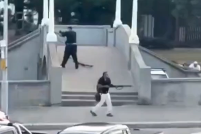
The result has been an immense escalation in violence, the collapse of basic services and mass displacement of civilians. According to rights groups and health networks, hundreds and possibly thousands of civilians have been killed in the aftermath and now shocking satellite images have emerged to support the same.
What is happening in Sudan's Darfur and El Fasher
For several painful years, the Darfur region has been marked by conflict, but the current crisis began in earnest in April 2023 when the RSF and the SAF turned to outright enemies. Moreover, this civil war rapidly deepened into one of the world's worst humanitarian disasters, with millions displaced and tens of thousands killed. El Fasher, under siege by the RSF for over a year, had its access to food, medicine and safe exits severely restricted. The siege prevented humanitarian deliveries and trapped many civilians in starvation conditions.
When the city fell to the RSF, the SAF withdrew as per reports. After the takeover, numerous witnesses and aid organisations reported summary executions, attacks on hospitals and civilians trying to flee. The Sudan Doctors Network reported at least 1,500 killed within days, describing the situation as 'a true genocide'. Regional states, including Saudi Arabia and Egypt, formally condemned the RSF's actions. Sources say the main groups targetted were non-Arab ethnic groups like the Fur, Zaghawa and Berti. As per reports El Fasher is now under RSF control with all five Darfur state capitals in their hand. This shifts the balance of power and raises fears of further ethnic based violence and territorial partition.
@aljazeeraenglish Satellite images, analysed by Yale University researchers, reveal streets stained with blood and piles of bodies in Sudan’s el-Fasher. The RSF took over the city on Monday, with witnesses describing summary executions and ethnic cleansing. #news #Sudan
♬ original sound - Al Jazeera English - Al Jazeera English
The Satellite Images: What Do They Show?
The newest alleged evidence came in the wake of El Fasher's fall, when the Yale Humanitarian Research Lab (HRL) published an analysis of high resolution satellite imagery that appears to show striking evidence of mass killings. Their report highlights clusters of objects lying horizontally on the ground, reportedly measuring roughly 1.3 to 2 metres in length, consistent with the size of human bodies and allegedly located near RSF vehicles and roadblocks. The imagery also reveals reddish discoloration on the ground, in places where no such markings appeared in previously taken images. These stains are interpreted as possible blood-soaked earth or signs of mass casualties. The official report says,
'At least five of the six groupings have reddish discoloration on the ground nearby. All six of the object groupings first appeared in satellite imagery collected on 27 October 2025; by 28 October 2025 all groupings were still visible. Two of the groupings increased in number in satellite imagery collected between 27 and 28 October 2025. There are at least five RSF-consistent technical vehicles visible at these groupings in satellite imagery on 27 or 28 October 2025; at least one vehicle is a gun-mounted technical type vehicle. RSF and its aligned forces is the only armed actor with control of the documented terrain during this period. The objects visible at these groupings are consistent with the dimensions of human bodies. They are located approximately 300 meters from the earthen wall, or berm, that RSF built entrapping El-Fasher.'
Some reports have described the imagery as piles of bodies and pools of blood visible from space, emphasising the severity of the attack. Yet despite the graphic nature of the images, analysts caution that the satellite data alone cannot definitively prove the identity of the objects or the precise cause of the stains. Furthermore, other reports which had access to the same imagery, stated that they could not conclusively establish what the objects on the ground or the red splotches seen in the dirt were.
Still, when the satellite imagery is combined with videos, social media posts and witness testimony, the evidence becomes substantially stronger. HRL's report itself warns that the patterns it detected 'may be consistent with war crimes and crimes against humanity'.
© Copyright IBTimes 2025. All rights reserved.


