

Nasa shares 'Six Stories Of Life' on Earth with these breathtakingly beautiful photos
From bacteria to human life, not only is the view from space stunning, it is informative too.


As part of a series on life on Earth called "The Living Planet", Nasa has released a set of images under the title "Six Stories Of Life" that portray living organisms from space. Throughout this week, Nasa will share other unique views from space to analyse life on Earth and to understand the "search for life in other worlds".
The images are taken from space using satellites to help biologists and researchers on the ground study the Earth and the way plant and animal life interact with the planet. Nasa pointed out that this list of photos that they have published is by no means exhaustive in portraying the different ways satellite imagery has been used by biologists.
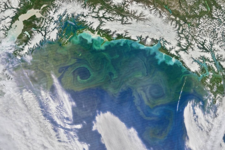
Single-celled "grass of the sea"
Phytoplankton, known as the powerhouse of the ocean, is among the most abundant forms of life in the seas. They are not technically plant life, but rather single-celled organisms that form the base of marine food chains. Nasa points out that they are also the only source of long-term transfer of carbon dioxide from the atmosphere into the ocean. Small changes in the quantity of plankton can cause significant changes in the Earth's CO2 levels, affecting global temperatures. Using Sea-Viewing Wide Field-of-View Sensor (SeaWiFS), the space agency has been studying the oceans since 1997.
Following outbreaks of bacterial diseases
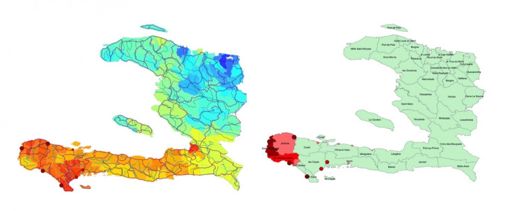
Cholera is a waterborne disease that can be found on the surface of zooplankton as well as in contaminated water on land. Medically called ibrio cholerael, the disease can cause severe diarrhoea, which could eventually lead to death. Nasa says that while their satellites can't actually pick up the cholera-causing bacteria from space, they can sense conditions in which it can thrive. Knowing where the bacteria can multiply helps researchers prepare better for outbreaks. The below maps show Haiti's satellite data two weeks after Hurricane Matthew hit in October 2016.
Tracking birds
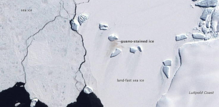
Nasa has reportedly been studying birds and their migratory patterns for years by using different methods. But one of the most interesting approaches used to monitor penguins in Antarctica has been to use satellite imagery to look for emperor penguin excrement. They apparently stain the otherwise white ice with their "guano" which gives an effect of contrast that can be captured through satellite images. Emperor penguin populations are followed using this method because Nasa says that the white and black coats of penguins make it difficult to monitor them since they blend in with shadows or with the ice.
Watching the Earth 'breathe'
Changes in climate and growth of vegetation can be captured by satellites in space, which makes it possible to observe the entire planet while it 'breathes'. Apart from plant life blooming and wilting, the ice caps are also photographed progressing and retracting, along with plankton blooming in the sea and swirling in the oceans.
Life under the sea
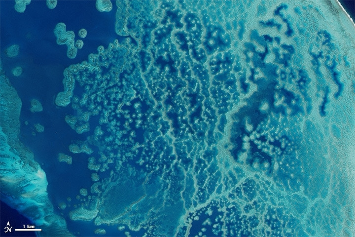
Nasa has been looking at the oceans for a while now to help researchers. For example, satellite imagery can be used to find waters suitable for oysters or to help protect the now endangered blue whale. Nasa also helps scientists monitor coral reefs, which are one of the most vulnerable ecosystems on the planet. Coral reefs are adversely affected due to the fact that they get bleached out by rising ocean temperatures. This effect is studied from space as well as from Nasa aircrafts that fly over these regions, along with the help of underwater scuba divers collecting data firsthand.
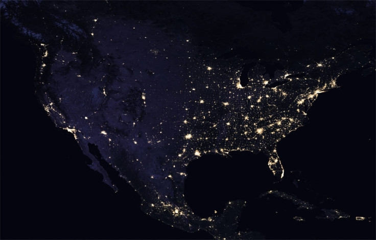
Observing human life from space
The impact of the most dominant species on Earth, humans, is also observed from space. Everything, from driving cars to constructing buildings to farming, impacts the Earth in some way and it can be seen from space, noted Nasa. "Black Marble", Nasa's study of humans from space at night, shows how cities and human development have progressed over time. It was recently used to chart out the regions in Puerto Rico that were severely affected by Hurricane Irma.
- MOST READ


