

Rainbow clouds: Incredible images emerge of rare phenomenon in Australia
Rare spectacle is result of ice crystals in sky bending sun's rays.
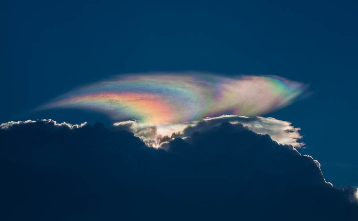
Residents of Darwin, Australia, were treated to a spectacular aerial sight when clouds with rainbow linings appeared just before a storm.
The rare spectacle is the result of ice crystals in the sky bending the sun's rays in such a way that the clouds appear iridescent with a multi-coloured glow around their edges much like the colours in an oil slick or soap bubbles.
Residents of the northern Australian city posted images of the clouds on social media, accompanied by descriptions such as "ice prism" and "cloudbow".
Specific conditions have to occur for the rainbow colours to be visible.
"Very specific angles are needed to see the colours, so the position and height of the storm, the angle of the sun and the size of the ice crystals all came together to give Darwin a rare, perfect view of the iridescence," Peter Markworth, a meteorologist at Australia's Bureau of Meteorology, told news.com.au.
Markworth explained that the type of clouds seen in the images are known as pileus clouds, usually indicators of severe weather. They are formed when water vapour condenses and freezes into uniform ice crystals after a rapid updraft.
In other strange cloud-related happenings, Nasa has released a spectacular photo snapped by an astronaut aboard the International Space Station of a massive vertical cloud formation extending high into the atmosphere over the Bahamas and measuring 15,000ft deep.
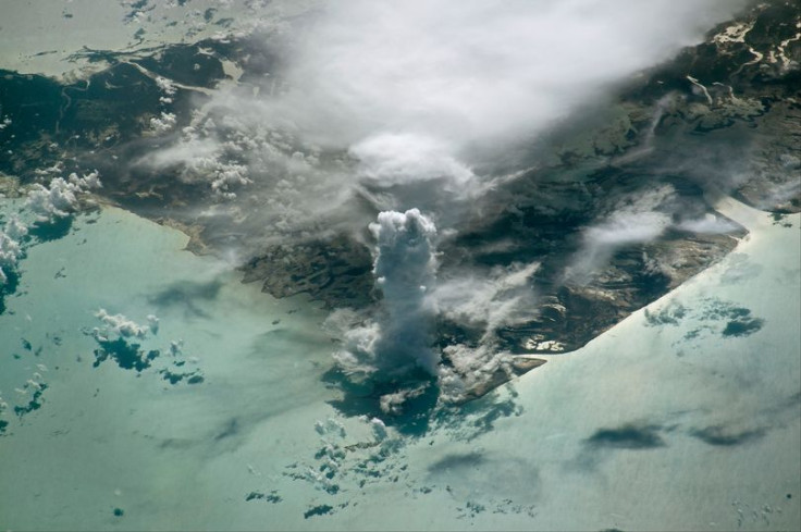
This type of cloud is referred to by meteorologists as cumulus castellanus, named in reference to its similarity to the turreted towers of medieval castles.
- MOST READ


