Tropical Storm Jerry Update: Why a New Atlantic Monster is Threatening the Caribbean?
Invest 95L set to become Tropical Storm Jerry. Leeward Islands on alert for winds and heavy showers by Friday.

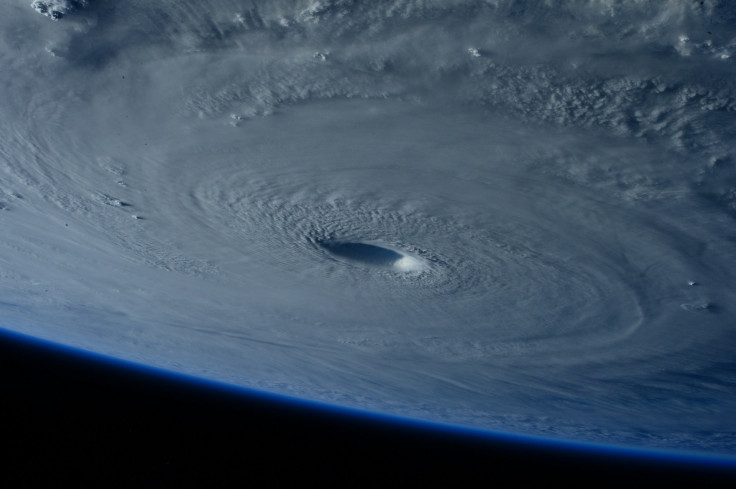
Just as the Atlantic calms down following the havoc of Humberto and Imelda, a new and highly organised weather disturbance is brewing that is poised to become the 10th named storm of the 2025 hurricane season.
Invest 95L, the ominous cluster of low pressure and showers, is rapidly strengthening between Africa and the Lesser Antilles and is expected to develop into Tropical Storm Jerry within the next day or so.
The system's quick formation is now sparking anxiety among residents from the Caribbean to the US east coast. Current forecasts suggest that the storm is set to pass close to the Leeward Islands by Thursday and Friday.
While the most likely scenario sees the storm curling safely northeast into the open Atlantic after passing the Caribbean, AccuWeather forecasters have already advised residents to closely monitor the tropics. This is not the end of the Atlantic hurricane drama; it is merely the latest chapter.
The Imminent Threat to the Leeward Islands
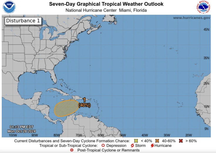
The disturbance, currently known as Invest 95L or AL95, is showing all the signs of rapid organisation, leading the National Hurricane Center (NHC) to identify it as a feature of interest.
The term 'Invest' is used to identify features that could develop, allowing high-resolution computer models to zero in on the exact threat. The first Hurricane Huntermission into the system is tentatively scheduled for Wednesday morning.
The most immediate danger is to the Caribbean. The system will continue to move quickly toward the west-northwestover the next few days, bringing it near or just north of the Leeward Islands by Thursday night or Friday. Most computer forecast model guidance suggests it could become Tropical Storm Jerry by that time, if not sooner.
The precise timing of its northward turn will be crucial:
- A faster turn will mean a simple brush of showers, gusty winds, and high surf for the Leeward Islands, PuertoRico, and the Virgin Islands.
- A slower turn will mean heavier showers and higher winds for those islands.
Why 'Future Jerry' is Still a Worry for Florida
Though Jerry is forecast to curl northeast and stay east of Bermuda, the storm's ultimate path remains too early to definitively determine. The current consensus is that the system will curl north into the central Atlantic, much like many other storms this season, meaning it is not currently a threat to the mainland US.
However, the speed and location of that northward curl are subject to change, which is why AccuWeather forecasters have urged Florida and East Coastresidents to monitor the situation closely.
The National Hurricane Center uses only the top four or five highest performing computer models to create its official forecasts. While the 'spaghetti models' may illustrate an array of forecast tools, it is the NHC's official cone that illustrates the most likely path of the storm's centre.
Second Alarm: The Gulf of Mexico System
In addition to Invest 95L, the NHC is also monitoring a second area over Mexico's Yucataˊn Peninsula for potential tropical development. For now, there is a less than 50/50 chance that this disturbance could develop in the Bay of Campeche in the far southwest Gulf before it moves into eastern Mexico by Thursday.
Regardless of whether it develops into a named storm, the main threat from this system is locally heavy, flooding rainfallacross Belize, northern Guatemala, and southern Mexico over the next few days. This ongoing activity shows how Hurricane Season typically intensifies or changes as it moves into October.
© Copyright IBTimes 2025. All rights reserved.
- MOST POPULAR IN World