UK on Alert: What 75 mph Winds Mean for Your Commute, Flights & Weekend Plans

Commuters across the UK are being urged to prepare for significant travel disruption as the Met Office issues yellow warnings for wind and rain, with gusts of up to 75 mph forecast.
A deepening area of low pressure is predicted to drive heavy rain into southern England late on Wednesday, spreading northeast through Thursday, with the wind and rain warning in force across much of England, Wales, and parts of the Midlands.
The Met Office warns of 'power cuts, transport disruption and damage to buildings.'
Commuter Disruption Likely
For daily commuters, the timing of the storm could make travel challenging during rush hours throughout the week.
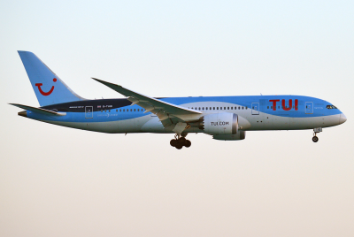
The Met Office has warned of potential disruption to road, rail, air, and ferry transport as strong winds and heavy rain sweep across the country.
Fallen branches, debris, and surface flooding may affect road networks, while bus and train services could face delays or cancellations—especially in southern and eastern parts of Britain where heavy rain is expected.
Commuters are advised to check live travel updates before setting out and adjust their plans as necessary.
Drivers should take extra care, particularly in open and rural areas, as strong northwesterly winds could make some routes hazardous.
High-sided vehicles are especially at risk on exposed roads and bridges, according to the regional yellow wind warning for Nottinghamshire.
The Met Office noted that strong winds may cause travel disruption and minor damage across eastern England on Thursday, with a small chance of longer journey times or cancellations due to adverse weather conditions.
⚠️ Yellow weather warning issued ⚠️
— Met Office (@metoffice) October 21, 2025
Strong winds across southern and eastern England
Thursday 0900 - 2359
Latest info 👉 https://t.co/QwDLMfS950
Stay #WeatherAware⚠️ pic.twitter.com/VLpfCkI4KK
Where Will It Hit Hardest?
The strongest winds are forecast across southern England and Wales, with gusts reaching up to 75 mph before easing slightly as the system tracks northwards.
Inland areas could experience gusts of 45–55 mph, with up to 65 mph possible near coastal zones.
Parts of the Midlands, including Nottinghamshire, are expected to experience disruptive bursts of wind and heavy rain, which may affect exposed roads and bridges.
Commuters in these regions should stay alert to local travel updates, as wind intensity may vary sharply within the yellow warning area.
Further north, blustery showers and isolated thunder are likely across northern England and Scotland as the system weakens, though slippery conditions and reduced visibility could still cause delays.
Coastal communities in southern and western Britain are also urged to take extra care near seafronts, as large waves and sea spray could make promenades and coastal routes dangerous during the storm's peak.
Weekend Plans? Monitor the Outlook
While the worst of the wind is forecast for Thursday, residual showers and gusts may linger into Friday morning.
Those planning outdoor or travel-heavy weekends are advised to check before you go, allow flexible time, and be prepared for changes to train or road journeys.
While the storm is expected to ease by Saturday, lingering rain and blustery spells may still affect early weekend plans.
Even if the storm remains unnamed, forecasters warn that its timing could make for a messy end to the working week.
Outdoor events and coastal activities may need to be rescheduled, as waves and spray could make seafronts dangerous.
Met Office Advice: Safety First
The Met Office continues to advise people to prepare early, drive carefully, and avoid unnecessary travel during the worst conditions.
Coastal areas, in particular, should be approached with caution due to large waves and slippery promenades.
For most people, this might be the kind of weekend best spent indoors—charging devices, watching a film, and letting the storm pass.
After all, if your plans can be postponed, it's probably wiser to stay home, stay dry, and let nature have the last word.
© Copyright IBTimes 2025. All rights reserved.
- MOST POPULAR IN National