Google Maps Shows Gaza in Ruins as Un Says 82% of Structures Are Damaged and Reported Death Toll Tops 74,000
The images, whose capture and upload dates remain unconfirmed, depict destruction in Rafah and around Al-Shifa Hospital alongside UN damage estimates

Google Maps satellite views shared online over the past day show devastated neighbourhoods across Gaza, where the UN says 82% of structures have sustained damage and Gaza's Health Ministry reports more than 74,000 Palestinians killed in Israel's war since October 2023.
The UN damage estimate dates to 16 June 2026, while the ministry's death toll covers the war since 7 October 2023. Users say Google Maps has recently updated its imagery, although the capture and upload dates remain unconfirmed.
What Google Maps Shows
Across parts of Gaza, streets pass through blocks of grey rubble, with buildings difficult to distinguish beneath the debris. Markers for schools, mosques, parks and restaurants remain visible on the map. Their presence identifies mapped locations, but does not establish whether those buildings still stand.
The New Arab said it had not independently established when the Google Maps images were captured or added, or which areas had changed. It has contacted Google for comment.
Separately, Google Earth imagery captured on 25 February 2026 shows extensive destruction in Rafah, according to an Al Jazeera analysis.
The Saudi neighbourhood in Tal al-Sultan, including a housing project containing hundreds of units, was largely flattened. Few structures remained in the former Swedish village. Rafah had also been a major refuge for Palestinians displaced from other parts of Gaza.

Around Al-Shifa Hospital, the satellite views show destruction at and around the medical complex. Israeli forces withdrew on 1 April 2024 after a two-week siege. A World Health Organization mission arriving days later described an 'empty shell' and reported extensive damage to its emergency, surgical and maternity buildings.
For Abubaker Abed, a Palestinian journalist from central Gaza who left with his family in April 2025, the images showed places he knew. 'I couldn't even bear continuing looking at that because seeing the place where I grew up, seeing the place where I was born, lined in ruins in that way was absolutely heart shattering,' he said.
Beyond the Google Maps Images
The UN Satellite Centre, UNOSAT, estimated that about 201,290 structures had sustained damage by 16 June 2026. Of those, 134,422 were classified as destroyed and 13,848 as severely damaged.
An earlier UNOSAT assessment recorded around 7,112 newly damaged structures in Rafah governorate between April and July 2025, placing it among the areas with the sharpest increases.
On 19 September, the ministry had reported 73,910 deaths and 174,914 wounded. Its figures include deaths subsequently verified and added to the official count, alongside people recorded as killed and wounded during the conflict.

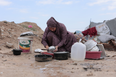
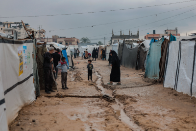
Along Gaza's coast, rows of makeshift shelters are visible in the satellite imagery. A UN report published on 24 September estimated that around 1.9 million people had been displaced, many repeatedly, and more than 60% of the population had lost their homes.
The Palestine Shelter Cluster said earlier this month around two-thirds of households were living in tents or makeshift shelters.
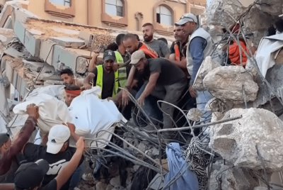
The UN Office for the Coordination of Humanitarian Affairs separately reported that more than 630 bodies and human remains were recovered beneath destroyed buildings between November 2025 and September 2026.
The Palestinian Civil Defence estimates that more than 8,000 people remain missing under the rubble.
'People right now can see the destruction themselves,' Abed told The New Arab. The images show damaged neighbourhoods and coastal encampments, where makeshift shelters now occupy broad stretches of land.
© Copyright IBTimes 2026. All rights reserved.
- Recommended For You