

Mysterious Amazonian geoglyphs suggest deforestation is a modern phenomenon
Geoglyphs in the Amazonian forest were not created via large-scale deforestation.

Humans have taken trees down in the Amazonian rainforest for millenia, but it never to the same scale as present.
Amazonia has traditionally been seen as a pristine wilderness, prior to the arrival of the Europeans, a place where no humans lived or impacted the landscape.
This view has been overturned in recent years as archaeologists have discovered the existence of geoglyphs in many regions of the Amazonian basin –impressive geometric earthworks created on the ground by ancient populations by taking down trees or playing around with other natural features of the landscape.
Large geoglyphs in Brazil suggest that these societies already engaged in deforestation to produce them.
However, there is still no scientific consensus about the extent to which they transformed their environment through deforestation and forest management.
A study now published in PNAS investigates the issue, assessing the extent of deforestation at the time these geoglyphs were made, as early as 3,500 to 3,000 years ago.
Its findings could prove crucial to improve the conservation of Amazonia today. Indeed, understanding the nature and extent of the landscape transformations by early societies can change how we perceive Amazonian forests in the present and conserve them in the future.
"Crucially, if the region's forests were intensively cleared for geoglyph construction and use, this might imply that terra firme forests are more resilient to human impacts than previously thought," the scientists say.
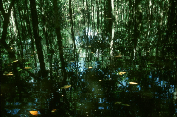
Bamboo forest
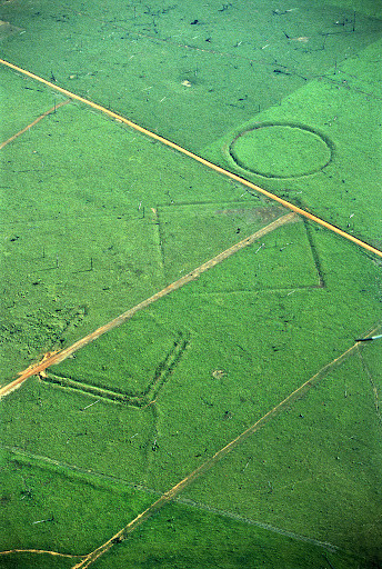
Most geoglyphs were built and used between 2,000 and 650 years ago and had a ceremonial and spiritual purpose. Not much is known about the societies that created them, but it is thought that they were a mix of autonomous groups linked together by a shared culture and ideology.
The scientists, led by Jennifer Watling of the University of São Paulo, wanted to find out what the vegetation was like at the time these populations lived and what impact they had on it.
They conducted isotope analyses of phytolith, charcoal, and stable carbon samples collected within radiocarbon-dated soil profiles at two geoglyph sites called Jaco Sá and Fazenda Colorada.
Their results indicate that a bamboo forest dominated the region for the past 6,000 years and that only small, temporary clearings were made to build the geoglyphs.
Instead, geoglyph construction was associated with a long and sustainable tradition of forest management that altered the composition of the native bamboo forest over millennia. The geoglyphs were the result of a long-term transformation of forests, rather than of sudden, large-scale deforestation. Only small-scale clearing of trees occurred to create the motifs.
The authors say that there was nothing similar in the past to the current deforestation of the Amazonian rainforest, so "we should not assume forest resilience to this type of land use, nor its recovery in the future".
What is an isotope analysis?
An isotope analysis is the examination and identification of the distribution of stable isotopes within chemical compounds - their isotopic signature.
It is used in a range of scientific fields from biology and chemistry to archaeology and can be used to infer past diets, the origins of artefacts or the composition of past landscapes
© Copyright IBTimes 2025. All rights reserved.
- MOST READ


