

UK weather: Arctic blasts will cover the UK in deep snow later this week says Met Office
Even London could be affected by a freezing winds hitting the UK in January 2017
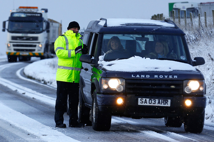
Much of the UK will covered in snow later this week as temperatures plunge below zero.
An Arctic blast will sweep over the British Isles on Wednesday (11 January) with up to 10cm (3in) of snow predicted in Scotland, Wales, the north of England, the Midlands. Wintry showers may even hit London and the south of England, a Met Office spokesman told IBTimes UK.
Temperatures are predicted to be around 2C to 5C during the day and sub-zero overnight, possibly -10C in rural areas. A severe weather warning has been issued for Wednesday, Thursday and Friday with drivers warned to take extra care on icy and snowy roads, allowing plenty of time for journeys.
Met Office spokesman Oli Claydon told IBTimes UK: "There will be a change in the weather type coming through from Wednesday with windy, snowy conditions towards the end of the week."
Friday is predicted to be the coldest day of winter. Coastal areas will be particularly vulnerable to deep snow as cold air moves in from the sea – gales and hail are also expected. No part of the UK is thought to be immune from the possibility of snow.
"There's a possibility of wintry showers in London," Claydon said. "We need to keep an eye on it closer to the end of the week." At the very least, Londoners have been told to brace themselves for freezing winds and frosty mornings.
Jenny Rourke, the Met's deputy chief operational meteorologist, said: "A cold spell of weather will affect the UK from Wednesday onwards. With strong northwesterly winds all areas will feel the cold and there will be snow showers, especially in northern and western areas.
"With wintry weather anticipated later this week, we've issued weather warnings for snow and wind and we advise people to check the latest forecast and weather warnings before they travel."
The #Jetstream will bring unsettled weather this week, moving southwards from midweek bringing #cold #Arctic air and the risk of #snow pic.twitter.com/6kMpEY4Cmo
— Met Office (@metoffice) January 8, 2017
© Copyright IBTimes 2025. All rights reserved.
- MOST READ


