

UK weather: Warnings issued as thunder, hail, torrential rain and flooding set to batter London

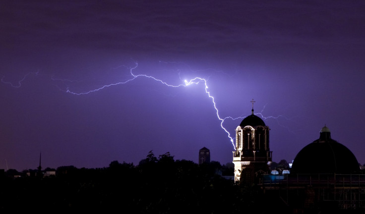
Large parts of the UK have been warned to expect thundery showers on Tuesday 7 June, with the Met Office issuing 14 severe weather warnings for rain. Showers will reach London by 1pm and the severe rain warning is expected to remain heavy until 8 June morning.
A chief forecaster for the Met Office warned that parts of the UK could see up to 20mm or more of rain within one hour, with as much as 50mm within a few hours. The showers are expected to last into the night, easing during the early hours of 8 June before returning again in the afternoon.
A spokesperson for the Met Office said: "Heavy, thundery showers will turn locally torrential with the risk of hail on Tuesday afternoon and evening across parts of England, Wales and Northern Ireland. While most places will miss the worst, please be aware of the risk of localised flooding."
The Environment Agency has issued two flood alerts in London and Bristol, urging people to "be prepared". In London, Putney, Chiswick, Mortlake, Twickenham and Teddington Lock are likely to be affected by the River Thames flooding .
Meanwhile, people in Northern Ireland were awoken by thunderstorms and intense downpours on the night of 6 June. Storms have been dominating much of Europe, with heavy flooding killing 17 people across the continent.
France has been enduring one of the worst storms, causing the River Seine in Paris to reach its highest level for 30 years at 6.1m on 4 June. The Met Office has warned that due to further heavy rain expected this week, it is unlikely that levels will return to normal within the next few days, with France and Denmark on higher "amber" levels of lightning.
#Thunderstorms affecting parts of #Europe and the UK today. Each coloured cross on the image is a #Lightning strike pic.twitter.com/JHSg42QpaI
— Met Office (@metoffice) June 6, 2016
In Germany, at least 71 people were injured by lightning strikes during a rock festival on 4 June. On 7 June, severe weather warnings for lightning were in place in Denmark, France, Greece, Italy, Luxembourg, Macedonia, the Netherlands, Portugal and Slovenia.
A spokesperson for the Met Office said: "It continues unsettled across large parts of continental Europe for the next five or six days. The most intense thunderstorms, focused across central and eastern parts of France, Belgium, western Germany, Switzerland and northern Italy, may produce as much as 100mm in three hours or less, along with large hail and strong winds."
UPDATE [12.13pm]: This article was edited to reflect the extended weather warning issued by the Met Office.
© Copyright IBTimes 2025. All rights reserved.
- MOST READ


