

Australia's Darwin braces for storm as Queensland recovers from aftermath of Cyclone Debbie
Bureau of Meteorology says the storm is likely to strengthen into category one Cyclone Frances late on 11 April.
The Australian Bureau of Meteorology has issued a warning in the country's Northern Territory of an approaching tropical storm that could strengthen to become category one Cyclone Frances by Tuesday night (11 April). The new cyclone warning comes as Queensland continues to recover from the aftermath of Cyclone Debbie that hit the state two weeks back.
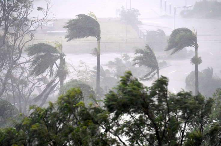
Heavy rains, high waves and gusts of about 100km/h are expected as the storm hits Tiwi Islands and Darwin. Wild weather is also expected in Palmerston, Jabiru, Wurrumiyanga, Milikapiti and Pirlangimpi.
The Met department has predicted that the storm could hit Tiwi Islands by Tuesday night and could lead to flooding, damaging waves and gales with gusts of up to 110 km/h. The tropical storm is located in Arafura Sea about 230km northeast of Darwin, the bureau said on Tuesday morning.
"Damaging winds averaging 60 to 70 km/h with peak gusts of around 90 km/h are forecast for the Tiwi and northwest Arnhem Districts during tonight and extending into the northern Daly on Tuesday," the met office noted.
It added: "Heavy rain which may lead to flash flooding with 24 hour rainfalls totals of 100-150mm is expected for the Tiwi and northwest Arnhem Districts during tonight and extending into the northern Daly on Tuesday."
Police in the Northern Territory have advised residents to pack emergency kits and take shelter in strong buildings. They have also warned them against any unnecessary travel in the next few days, according to NT News.
Authorities in Tiwi Island said that the residents are well prepared for the approaching tropical storm, with hundreds picking up essential items overnight from supermarkets.
NT Emergency Services regional manager Mark Cunnington cautioned people to "stay alert and not alarmed" by the approaching storm. "Understanding that the probable effect over the Tiwis and into Darwin is likely only to be Category One, a cyclone is a cyclone and they can still surprise us from time to time with their development," he said.
"We're recommending that people have their cyclone kits ready, their yards cleared of any debris that may be picked up in wind situations and be ready to shelter when the weather starts to deteriorate," he added.
© Copyright IBTimes 2025. All rights reserved.
- MOST READ


