Hatteras Island Mandatory Evacuation: Could Hurricane Erin Temporarily Render Zone A Uninhabitable?
Zone A includes Rodanthe, Avon, Buxton, Frisco and Hatteras Village

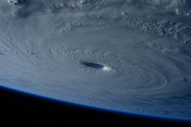
A sweeping mandatory evacuation is underway for Hatteras Island as Hurricane Erin barrels toward North Carolina's Outer Banks. Officials warn of historic flooding, life-threatening storm surge, and severe erosion even if the storm does not make direct landfall. With Erin rapidly intensifying, Dare County leaders have taken decisive action to safeguard residents and visitors in the most vulnerable areas.
The evacuation order took effect on Monday, 18 August for all visitors and will expand on Tuesday, 19 August to include residents of Zone A. According to the county's State of Emergency declaration, all residents of Rodanthe, Waves, Salvo, Avon, Buxton, Frisco, and Hatteras Village must be off the island by 8 a.m. Tuesday.
Hurricane Erin has prompted mandatory evacuation orders for Hurricane Zone A (Hatteras Island) in Dare County, NC.
— Weather WatcherX (@WeatherWatcherX) August 18, 2025
THIS IS A STATE OF EMERGENCY! EVACUATE NOW!#HurricaneErin #wxtwitter #Tropics #NCwx pic.twitter.com/OtqjeAzjYW
Why Evacuation Is Critical
Officials stress that staying behind could have dire consequences. Once winds strengthen and water overtops low-lying highways, first responders may be unable to reach stranded residents. NC Highway 12, the island's only major route, has a long history of flooding and washouts during storms, cutting off entire villages from the mainland.
As 13 News Now reported, Zone A was designated as the most vulnerable evacuation zone because of its low elevation and direct exposure to the Atlantic. Dare County Emergency Management warned that 'failure to comply could leave residents stranded,' with rescue operations impossible until conditions improve.
To aid the evacuation, Dare County has prepared mainland shelters and coordinated ferry services to move both tourists and locals to safety. Evacuation routes will remain open as long as possible, but officials stress the importance of leaving early to avoid being trapped.
Hurricane Erin's Escalating Strength
As of Monday afternoon, Hurricane Erin was fluctuating between Category 3 and Category 4, with forecasters warning of further intensification overnight and into Tuesday. Although the storm's center is not projected to make direct landfall in North Carolina, its sheer size could deliver destructive conditions well beyond its core.
According to AP News, Erin has already caused extensive flooding and power outages across Puerto Rico and the U.S. Virgin Islands. Meteorologists point to unusually warm Atlantic waters as a driver of the storm's rapid intensification, raising concerns that powerful hurricanes are becoming more frequent due to climate change.
Why Hatteras Island Faces Greater Risk
Hatteras Island's geography makes it particularly vulnerable. It is a slender barrier island, with some points measuring only a few hundred meters from ocean to sound. NC Highway 12, the island's lifeline, is regularly washed out during hurricanes.
Past storms highlight the dangers. Hurricane Isabel in 2003 carved a new inlet through the island, while Hurricane Dorian in 2019 caused widespread flooding and road damage. Officials fear Erin could produce similar disruptions, isolating residents and halting the tourism industry that sustains the Outer Banks economy.
The overall size of Hurricane Erin is still going to cause impacts even without a direct landfall. State of Emergency just declared for Dare County, NC. with a mandatory evacuation for Hatteras Island. Calling for extreme beach and coastal damage, inland flooding, and 15-20 foot… pic.twitter.com/JBeS2FNZIj
— Mike's Weather Page (@tropicalupdate) August 17, 2025
Emergency Response And Safety Measures
Dare County's emergency declaration has mobilised resources and coordinated agencies at the state and federal levels. The U.S. Coast Guard, the North Carolina Department of Transportation, and local emergency crews are working together to maintain ferry operations and keep evacuation routes clear.
Residents have been urged to secure their homes, move vehicles to higher ground, and bring only essential belongings. Mainland shelters are available, with accommodations for those who do not have private transportation or who need medical support. Authorities caution that once conditions worsen, emergency crews may be unable to respond until after the storm passes.
Barrier Islands Under Climate Pressure
The evacuation underscores the growing vulnerability of barrier islands along the Atlantic coast. Rising sea levels and intensifying hurricanes are accelerating erosion and threatening the long-term viability of these communities. Hatteras Island, renowned for the Cape Hatteras Lighthouse, its beaches, and sport fishing, increasingly finds its economy and way of life disrupted by severe storms.
The urgent retreat from Hurricane Erin is a stark reminder of the fragile balance between preserving the natural beauty of the Outer Banks and confronting the escalating risks posed by climate change. For Hatteras residents, the decision to evacuate is not just about this storm but about adapting to a future where powerful hurricanes may become the new normal.
© Copyright IBTimes 2025. All rights reserved.


