

UK weather forecast: Storm Barney strands commuters and leaves thousands without power

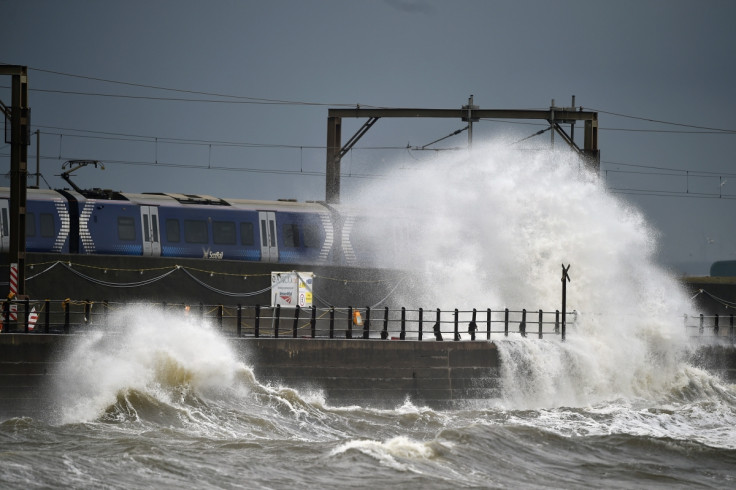
Thousands of homes were left without power on Tuesday night (17 November) as Storm Barney battered parts of the UK. Gusts of up 85mph were recorded in parts of Wales, reaching well above the predicted wind speed of 60mph for the region.
Thousands of homes were left without power in Wales, the Midlands and in southern and eastern England, despite efforts from electricity engineers to restore power throughout the night.
Electricity construction and maintenance company ESB Networks said that its crews had restored power to 30,000 customers during the night. However, 15,000 homes and businesses were reported to still be without electricity on Wednesday morning.
A representative for the company said: "The gale force winds caused considerable damage to the electricity infrastructure mainly due to trees and timber falling onto the network. There are high winds forecast for today also, and this could hamper the restoration process and cause additional faults."
The strong gales also caused travel disruption across the country as trees fell on roads and train tracks. Train services Thameslink, the Gatwick and Stansted Express, and Southeastern were among those disrupted due to the weather, while major roads – including the M48 in Gloucestershire and the M25 in Essex and Kent – were said to be affected. Flights from major London airports were also affected.
Although Storm Barney has officially left the UK, the Met Office has issued further severe weather warnings for parts of Scotland and Northern Ireland, as well as severe wind warnings for the north of England.
Gusts of 50-60mph are likely over coastal regions, while gusts of 60-70mph can be expected in exposed areas inland. The warnings come into effect at midday on Wednesday and will remain in place until the early hours of Thursday, 19 November.
Warnings of heavy showers and longer spells of rain have also been issued, while the Environment Agency has issued two flood warnings for Yorkshire and York on Wednesday.
"Be aware of difficult driving conditions and the risk of some minor travel disruption on roads and to ferries," a representative for the Met Office said. "Frequent showers or some longer spells of rain may lead to some localised surface water flooding, given the very wet state of the ground."
Storm Barney was the second storm to be named by the Met Office this season and arrived just a few days after Storm Abigail battered British towns, causing widespread destruction. Flood schemes implemented by the Environment Agency are believed to have protected more than 20,000 homes during the storm, while more than 600m of temporary flood defences were put in place.
As the unsettled weather continues, forecasters have also warned that snow could hit the UK this weekend as temperatures fall to nearly 0C in some areas. Parts of Scotland and the north of England are expected to receive snowfall on higher ground by 20 November, with the possibility of snow making its way to lower ground later in the weekend.
The cold conditions could be the first glimpse of the "big freeze" that has been predicted for this winter, which is expected to be the coldest British winter in 50 years. Forecasters have expressed fears of a repeat of 1963, when the worst winter in history saw temperatures plummet to near -20C in January. According to reports snow blanketed the country for weeks and the River Thames froze.
© Copyright IBTimes 2025. All rights reserved.
- MOST READ


