

Nasa releases stunning new photos of Martian sand sheets and star dunes
The images published by Nasa were taken by the CRISM and HiRISE cameras orbiting Mars.
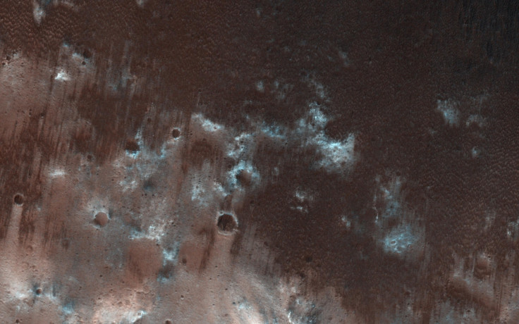
Nasa has released a number of pictures of the Martian surface shot by its Mars Reconnaissance Orbiter (MRO). They cover the border between the southern highlands and the northern lowlands and show the diverse nature of the surface of the red planet.
The images were taken by the Compact Reconnaissance Imaging Spectrometer for Mars (CRISM) working along with the HiRISE camera. The space agency is calling it "orbital prospecting" as it is using images to document and detect minerals on the surface.
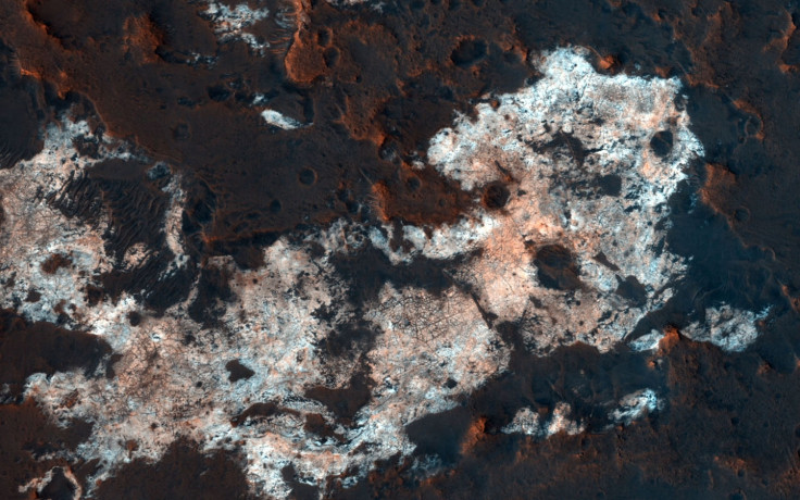
The region in the above picture named Mawrth Vallis has, according to a Nasa release, attracted a lot of attention because of the number of minerals that have been found and identified here. It is described as a large and "ancient" area of clay minerals which was active about four billion years ago, and also has a possible water-rich environment.
Mawrth Vallis is being considered as one of the two possible landing sites where the Mars Express Rover Mission will land and explore. The mission is being planned by the European Space Agency.
The minerals seen above are called alunite, hydrated aluminum potassium sulphate. Nasa says it is of interest because it must have been deposited in a wet, sulphuric acid-rich environment. The width of the image covers a cutout of 1.2 km.
The image depicts the sand sheets found inside the large Hershel crater which is seen upwind from a set of barchans. It is said that the image can help identify and study past environmental conditions on the planet and could prove to be an important link in a study centred on the habitability of Mars.
The image shows the weakening north to south blowing winds weakening and unable to build sand dunes; so instead, sheets of sand have been created inside the crater.
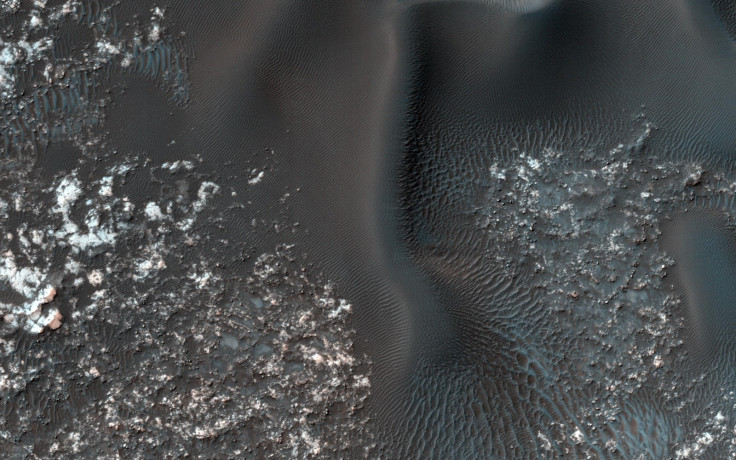
The left side of the above image taken by MRO is what Nasa is calling a set of "fairly textbook-looking barchan sand dunes" atop bedrock. Other barchan dunes pointing in the other direction are seen on the right side of the image. Between the two are "star dunes" formed by multiple winds carrying sand from different directions over time. Where this sand comes from is still a mystery, says Nasa.
All the images were captured and processed by Nasa and The University of Arizona, Tucson, that operates HiRISE and Nasa's own Jet Propulsion Laboratory in California that operates the MRO.
© Copyright IBTimes 2025. All rights reserved.
- MOST READ


