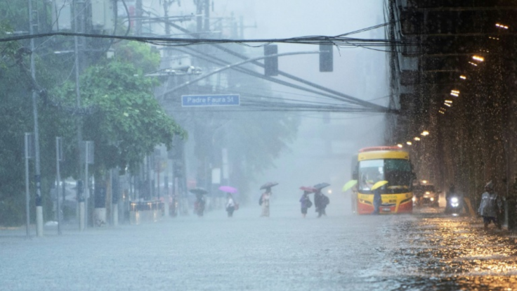
Super Typhoon Philippines Uwan Landfall: Citizens Asked To Brace - Could This Be The Strongest Storm Of The Year?
Forecasters warn that Typhoon Uwan, formerly Fung-wong, could reach super typhoon strength as it nears Luzon, threatening widespread damage and severe flooding.

A powerful weather system is bearing down on the Philippines, with forecasters warning that Typhoon Uwan could become one of the most destructive storms of the year.
The storm, currently named Fung-wong, has now intensified into a severe tropical storm and is drawing closer to the Philippine Area of Responsibility (PAR). As of 4 a.m. Friday, the system was located 1,470 kilometres east of Eastern Visayas, outside the PAR boundary. The storm currently carries maximum sustained winds of 95 kilometres per hour, with gusts reaching up to 115 kilometres per hour, and is tracking northwestward at a speed of 10 kilometres per hour.
From Fung-wong To Uwan
Once inside the PAR, expected by midnight or early Saturday, the storm will be renamed Uwan, the Cebuano word for 'rain'. Forecasters have warned that it could make landfall at or near its peak intensity over Northern or Central Luzon on 10 November 2025. The expected strength of the system has prompted early concerns from disaster officials, who have advised citizens in its projected path to make the necessary preparations.
Meteorologists have noted that the weather system's rapid intensification could bring life-threatening conditions across large sections of Luzon. Early warnings are expected to be raised as soon as Saturday morning for parts of eastern Luzon and the Visayas. The highest storm warning signal, Signal No. 5, may be issued should Uwan reach its maximum expected intensity upon landfall.
Potential Impact And Areas At Risk
Uwan's powerful winds are expected to extend up to 720 kilometres from its centre, potentially affecting a significant portion of the country during its passage. Even areas located far from the direct landfall point may experience damaging winds, heavy rainfall, and severe storm surges. Authorities have cautioned that the scale of impact could stretch beyond Luzon, with low-lying and coastal regions at particular risk of flooding.

In addition to wind damage, localised landslides and flash floods are possible in mountainous areas, especially where soil conditions are already saturated. The storm's broad circulation and strong rain bands could result in prolonged periods of rainfall, complicating relief and evacuation efforts. Emergency response teams have been placed on alert, with local governments urged to prepare temporary shelters and relief supplies.
Forecast Uncertainty And Continued Monitoring
Weather experts have noted that the uncertainty surrounding Uwan's exact track and intensity remains high. While some models predict a direct landfall over Northern Luzon, others suggest a possible shift in trajectory that could alter its impact zone. Given these variations, authorities have advised the public to stay updated through official weather bulletins.
Residents have been strongly urged to avoid complacency as the system continues to strengthen. The country's disaster management agencies have emphasised the importance of early preparation, especially for communities within or near the forecast cone. Travellers, fishermen, and residents in coastal areas have also been advised to closely monitor advisories and avoid unnecessary travel during the storm's expected approach.
Preparing For Possible Super Typhoon Conditions
Although classified as a severe tropical storm, Uwan's current rate of intensification raises concerns that it may reach super typhoon status once inside the PAR. Should this occur, it could bring destructive winds capable of uprooting trees, damaging infrastructure, and disrupting power and communication lines. The potential for significant storm surges adds to the threat, particularly in coastal provinces along the eastern seaboard.
Meteorologists have stressed that even localities outside the main impact area could face dangerous conditions. Heavy rainfall and flooding may occur hundreds of kilometres from the storm's eye due to its expansive wind field. Officials are reminding the public that vigilance and readiness are key, as forecast adjustments could be issued with short notice.
© Copyright IBTimes 2025. All rights reserved.


