Japan Backed UN Map Resolution Then Protested Russian Colouring of Disputed Kuril Islands
Cartographer Bojan Patterson will revise the Japanese-language version after Tokyo objected to the islands being shown in the same colour as Russia
Japan backed a United Nations resolution promoting a new world map, then lodged a diplomatic protest after the map's online version coloured four disputed Kuril islands the same as Russia.
The United Nations General Assembly adopted a resolution on 4 September 2026 encouraging the wider use of equal-area map projections, including the Equal Earth projection, co-created in 2018 by cartographers Bojan Šavrič, Tom Patterson and Bernhard Jenny.
The resolution passed with 164 member states voting in favour, including Japan. The United States was the only country to vote against it, while six countries, including Ukraine, abstained.
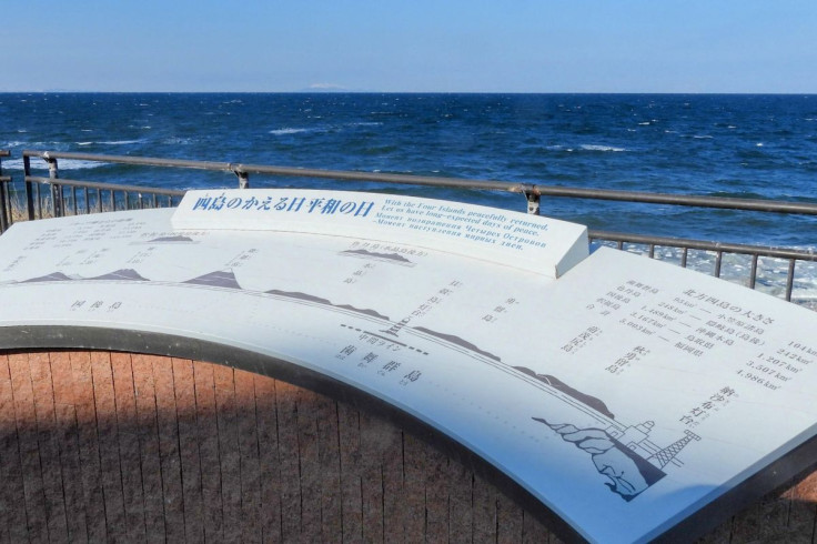
Japan later lodged a diplomatic protest over how the Equal Earth map displayed four disputed islands in the southern Kuril chain. Iturup, Kunashir, Shikotan and the Habomai island group were shown in the same colour as Russia on the map's website.
Japan Objects to the Map's Depiction of the Islands
Japanese Chief Cabinet Secretary Minoru Kihara said the colouring conflicted with Tokyo's position on the islands. Japan considers the four islands part of its territory and disputes Russia's administration of them.
Kihara said Japan had requested corrections through diplomatic channels. The aim, he said, was to prevent what Tokyo considers a misleading impression about the islands' status from spreading internationally. The issue arose despite Japan's support for the UN resolution endorsing the wider use of equal-area maps.
Cartographer Agrees to Change the Japanese Version
Patterson agreed to change the Japanese-language version of the map following Japan's protest. Under the revised version, the disputed islands will be shown in the same colour as Japan.
He said the English-language version would remain unchanged. Patterson explained that version was intended to represent Russia's de facto administrative control over the islands. The UN has stressed that the Equal Earth projection is a method for displaying the world and does not establish international borders or determine legal sovereignty.
Putin's Iturup Visit Deepened Japan-Russia Tensions
The disagreement over the map followed a renewed deterioration in Japan-Russia relations after Russian President Vladimir Putin visited Iturup in August 2026.
Japan summoned Russia's ambassador in response. Prime Minister Sanae Takaichi said the visit 'offends the sentiments of the Japanese people' and was 'absolutely unacceptable'.
She also said the islands were 'an inherent part of Japan's territory, both historically and under international law.'
Moscow rejected Japan's position and its diplomatic protests. Russia described Tokyo's statements as 'politically inappropriate, insulting and, of course, legally unfounded'.
Russia has said the legal question surrounding the islands is officially closed. Russian forces also conducted submarine missile exercises near the islands following Putin's visit.
Long-Running Dispute Over the Kuril Islands
Japan refers to the islands as the 'Northern Territories', while Russia calls them the 'Southern Kuriles'. The territorial dispute dates back to 1945, when the Soviet Union took control of the islands at the end of the Second World War. Japanese residents were expelled after the Soviet takeover.
Russia has continued to administer the islands, while Japan maintains its claim over them. The dispute has contributed to the failure of the two countries to conclude a formal post-Second World War peace treaty settling their bilateral relations.
How the Equal Earth Map Shows the World
The Equal Earth projection is an equal-area map design intended to show the relative sizes of countries and continents more proportionately than traditional Mercator-style maps.
On Equal Earth maps, Africa appears larger than it does on a Mercator map, while North America and Europe appear relatively smaller.
The four islands at the centre of the dispute are Iturup, Kunashir, Shikotan and the Habomai island group. Their colouring on the map became the focus of Japan's protest even though the underlying UN resolution concerns the use of map projections rather than the legal status of disputed territory.
Ukraine was among the six countries that abstained from the UN vote. Kyiv objected to the Equal Earth map's depiction of Crimea, which appeared in a different colour from the rest of Ukraine.
Ukraine's delegation argued that the map's depiction of Crimea risked legitimising Russia's claims over occupied territory and warned it could set a precedent undermining the UN Charter and international law.
© Copyright IBTimes 2026. All rights reserved.
- Recommended For You