Polar Vortex Risk: Forecasters Say 'Super El Niño' Could Raise Winter 2026-2027 Disruption Risks Across Parts of US and Europe
Long-range models suggest a strong El Niño and a potentially weakening polar vortex could reshape US and European winter weather
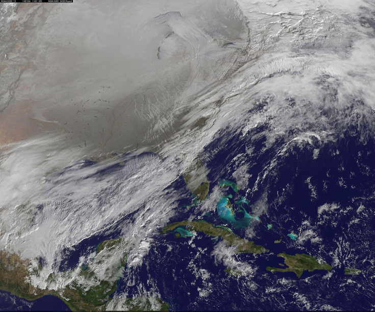
A major atmospheric pattern is already taking shape over the Arctic, with the seasonal polar vortex developing above the North Pole as forecasters monitor signs of a possible mid-winter weakening.
The latest long-range forecast points to a slowdown in the vortex during winter 2026–2027, while an unusually powerful El Niño is strengthening across the tropical Pacific.
The combination could reshape the jet stream and influence temperatures and storm tracks across the United States and Europe, although it is too early to say whether a major polar vortex disruption will actually occur.
Polar Vortex Develops as Winter 2026–2027 Signal Emerges
The polar vortex is a large area of low pressure surrounded by strong winds and cold air that forms around the poles and becomes stronger during the Northern Hemisphere winter.
The US National Weather Service says it can expand southwards, allowing Arctic air to move into the United States, Europe and parts of Asia, while stressing that the polar vortex itself is a normal winter feature.
The current long-range forecast shows the vortex beginning the season relatively strong, but forecasts indicate its winds could weaken around the middle of winter.
A major Sudden Stratospheric Warming (SSW) event cannot be reliably forecast this far ahead, but a substantial slowdown could alter the jet stream and increase the potential for cold-air outbreaks.
¡EL VÓRTICE POLAR HA RESUCITADO! 👻
— Meteorología Tamaulipas (@MeteoroTamps) September 15, 2026
🅱️🔄El #PV (Polar Vortex) comienza a intensificarse en el polo Norte como es habitual a estas alturas del año.
La incidencia de frentes fríos aumentará en las siguientes semanas. 🥶
Es la mejor temporada del año susurrándonos al oído…🙌… pic.twitter.com/wDbGvGbxxo
Why a Weak Polar Vortex Could Disrupt US and UK Weather
A strong polar vortex helps keep much of the coldest Arctic air concentrated near the pole. If the circulation weakens or becomes displaced, the resulting changes in atmospheric pressure and the jet stream can make it easier for Arctic air to move towards lower latitudes.
For the US, that could mean periods of much colder weather in parts of the country if the atmospheric pattern directs Arctic air southwards.
In the UK and Europe, the outcome is less straightforward because conditions also depend heavily on the North Atlantic circulation, meaning a polar vortex disruption does not automatically mean a prolonged freeze or widespread snow.
Very Strong El Niño Could Influence the Polar Vortex
The other major factor is the very strong El Niño developing across the tropical Pacific, with current forecasts showing a very strong event developing.
NOAA's latest forecast gives a greater than 90% chance of a very strong El Niño during the Northern Hemisphere autumn and winter of 2026–2027.
It also gives the event a 75% chance of reaching what it defines as historic strength during October–December, based on a threshold that exceeds the strength of previous El Niño events dating back to 1950.
Strong El Niño events can alter atmospheric circulation over the Pacific and North America and influence the flow of planetary waves into the stratosphere.
Long-range modelling for winter 2026–2027 currently shows a weakening of the polar vortex around mid-winter, suggesting the developing El Niño could be one factor influencing the broader atmospheric pattern. However, the forecast does not establish that an SSW or major vortex disruption will occur.
'El Niño Is Being Supersized' as Winter Risks Build
The strength of the Pacific warming has also drawn attention from the United Nations. Earlier this month, UN Secretary-General António Guterres warned that 'El Niño is being supersized before our eyes', as the World Meteorological Organization said the event is expected to strengthen into a very strong El Niño and persist through February 2027.
For winter 2026–2027, a very strong El Niño is expected to influence the jet stream and precipitation patterns, particularly across North America.
NOAA's seasonal outlooks show El Niño-related shifts in temperature and precipitation probabilities, but regional outcomes can vary considerably and are not guaranteed.
The latest long-range forecast therefore points to a potentially active winter, rather than a guaranteed season of extreme cold.
The National Weather Service also stresses that the polar vortex is a normal winter feature and that its presence alone is not a reason for alarm.
© Copyright IBTimes 2026. All rights reserved.
- Recommended For You